Budapest: Perbedaan antara revisi
Konten dihapus Konten ditambahkan
Tidak ada ringkasan suntingan |
Tidak ada ringkasan suntingan |
||
| Baris 1: | Baris 1: | ||
{{Infobox settlement |
{{Infobox settlement |
||
<!-- See Template:Infobox settlement for additional fields and descriptions --> |
|||
|official_name = Budapest |
|||
| name = Budapest |
|||
|population_demonym = Budapester |
|||
| official_name = Ibu kota Hongaria <br/>''Budapest főváros'' |
|||
|image_skyline = BudapestMontage.jpg |
|||
| settlement_type = [[Ibu kota|Kota]] |
|||
|imagesize = 290px |
|||
<!-- images, nickname, motto - --> |
|||
|image_flag = Flag of Budapest (2011-).svg |
|||
| image_skyline = {{nowrap|<!-- |
|||
|image_seal = Coa Hungary Town Budapest big.svg |
|||
-->[[File:The building of the Hungarian Parliament (10890208584).jpg|303px]]<br/><!-- |
|||
|image_map =BudapestMap23.png |
|||
-->[[File:Views from Fisherman's Bastion toward south. - Budapest, Hungary. - 62 365² Observador (8262965486).jpg|203px]]<!-- |
|||
|image_caption = Dari atas, kiri ke kanan: Pemandangan kota di tepi [[Sungai Donau]], singa menjaga [[Jembatan Rantai Széchenyi]], [[Hősök tere]], [[Gedung Parlemen Hongaria]], [[Halászbástya]], [[Basilika Santo Stefanus]], dan panomara Gellért dengan [[Istana Buda]] disebelah kiri |
|||
-->[[File:Budapest (agost 2012) - panoramio (49).jpg|101px]]<br/><!-- |
|||
|map_caption = Lokasi Budapest pada Hongaria |
|||
-->[[File:Seven chieftains of the Magyars and Statue of Gabriel. Millennium Monument. Budapest 029.jpg|105px]]<!-- |
|||
|coordinates_region = HU |
|||
-->[[File:Hungarian National Theater Budapest.jpg|93px]]<!-- |
|||
|subdivision_type = [[Negara]] |
|||
-->[[File:HUN-2015-Budapest-St. Stephen's Basilica.jpg|105px]]<br/><!-- |
|||
|subdivision_type1 = [[Daftar county di Hongaria|County]] |
|||
-->[[File:Széchenyi Chain Bridge in Budapest at night.jpg|303px]]<!-- |
|||
|subdivision_name = [[Hongaria]] |
|||
-->}} |
|||
|subdivision_name1 = Budapest, Ibu Kota |
|||
| imagesize = |
|||
|leader_title = [[Wali kota]] |
|||
| image_caption = Dari atas, kiri ke kanan: [[Gedung Parlemen Hongaria|Parlemen Hongaria]], [[Halászbástya]], [[Patung Kebebasan (Budapest)|Patung Kebebasan]] di [[Bukit Gellért]], [[Hősök tere|Alun-Alun Pahlawan]] di [[Taman Kota (Budapest)|Taman Kota]], [[Teater Nasional (Budapest)|Teater Nasional]], [[Basilika Santo István]] dan [[Belváros (Budapest)|Belváros]] dengan [[Jembatan Rantai Széchenyi]] pada malam hari |
|||
|leader_name = [[István Tarlós]] ([[Fidesz]]-[[KDNP]]) |
|||
| image_flag = Flag of Budapest (2011-).svg |
|||
|area_magnitude = 1 E8 |
|||
| image_shield = Coa Hungary Town Budapest big.svg |
|||
|area_total_km2 = 525.16 |
|||
| shield_alt = Lambang Budapest |
|||
|area_land_km2 = |
|||
| nickname = Jantung Eropa, Ratu Donau, Mutiara Donau, Ibu Kota Kebebasan, Ibu Kota Spa dan Pemandian Air Panas, Ibu Kota Festival |
|||
|area_water_km2 = |
|||
<!-- maps and coordinates ---- --> |
|||
|population_as_of = 2010 |
|||
| pushpin_map = Hungary#Europe |
|||
|population_note = |
|||
| pushpin_relief = 1 |
|||
|population_total = {{increase}} 1,721,556 |
|||
| pushpin_map_caption = Budapest di Hongaria |
|||
|population_density_km2 = 3241.5 |
|||
| coordinates = {{coord|47|29|33|N|19|03|05|E|format=dms|display=inline,title}} |
|||
|population_urban = {{increase}} 2,524,697 |
|||
| coor_pinpoint = |
|||
|population_metro = {{increase}} 3,271,110 |
|||
| coordinates_footnotes = <!-- location ---------------- --> |
|||
|blank2_info = [[GDP per capita]] = 36,118 USD |
|||
| subdivision_type = [[Negara]] |
|||
|timezone = [[Waktu Eropa Tengah|CET]] |
|||
| subdivision_name = {{flagcountry|Hongaria}} |
|||
|utc_offset = +1 |
|||
| subdivision_type2 = [[Region]] |
|||
|timezone_DST = [[Waktu Musim Panas Eropa Tengah|CEST]] |
|||
| subdivision_name2 = [[Hongaria Tengah]] |
|||
|utc_offset_DST = +2 |
|||
| subdivision_type3 = [[Subregion]] |
|||
|latd=47|latm=28|lats=19|latNS=N |
|||
| parts = 23 distrik |
|||
|longd=19|longm=03|longs=01|longEW=E |
|||
| p1 = [[Distrik I, Budapest|I., Várkerület]] |
|||
|elevation_m=|elevation_ft= |
|||
| p2 = [[Rózsadomb|II., Rózsadomb]] |
|||
|website = [http://english.budapest.hu/ budapest.hu] |
|||
| p3 = III., [[Óbuda]]-[[Békásmegyer]] |
|||
|footnotes = |
|||
| p4 = [[Újpest|IV., Újpest]] |
|||
|coordinates_display = title |
|||
| p5 = [[Distrik V, Budapest|V., Belváros-Lipótváros]] |
|||
| p6 = [[Terézváros|VI., Terézváros]] |
|||
| p7 = [[Erzsébetváros|VII., Erzsébetváros]] |
|||
| p8 = [[Józsefváros|VIII., Józsefváros]] |
|||
| p9 = [[Ferencváros|IX., Ferencváros]] |
|||
| p10 = [[Kőbánya|X., Kőbánya]] |
|||
| p11 = [[Újbuda|XI., Újbuda]] |
|||
| p12 = [[Hegyvidék|XII., Hegyvidék]] |
|||
| p13 = [[Angyalföld|XIII., Angyalföld]] |
|||
| p14 = [[Zugló|XIV., Zugló]] |
|||
| p15 = [[Rákospalota|XV., Rákospalota, Pestújhely, Újpalota]] |
|||
| p16 = [[Sashalom|XVI., Sashalom]] |
|||
| p17 = [[Rákoskeresztúr|XVII., Rákosmente]] |
|||
| p18 = [[Pestszentlőrinc|XVIII., Pestszentlőrinc-Pestszentimre]] |
|||
| p19 = [[Kispest|XIX., Kispest]] |
|||
| p20 = [[Pesterzsébet|XX., Pesterzsébet]] |
|||
| p21 = [[Csepel|XXI., Csepel]] |
|||
| p22 = [[Budafok|XXII., Budafok-Tétény]] |
|||
| p23 = [[Soroksár|XXIII., Soroksár]] |
|||
<!-- established ------------- --> |
|||
| established_title = Penyatuan [[Buda]], [[Pest, Hongaria|Pest]] dan [[Óbuda]] |
|||
| established_date = 17 November 1873 |
|||
<!-- government type, leaders --> |
|||
| government_footnotes = <ref name="municipality">{{cite web|url=http://budapest.hu/sites/english/Lapok/The-Municipality-of-Budapest.aspx|title=The Municipality of Budapest (official)|work=Municipality of Budapest|date=11 September 2014|accessdate=11 September 2014}}</ref> |
|||
| government_type = Wali Kota - Dewan |
|||
| governing_body = [[Majelis Umum Budapest]] |
|||
| leader_title = [[Wali Kota Budapest|Wali Kota]] |
|||
| leader_name = [[István Tarlós]] <small>([[politikus independen|independen]], didukung oleh [[Fidesz]])</small> |
|||
<!-- display settings ------- --> |
|||
| unit_pref = Metrik |
|||
<!-- area -------------------- --> |
|||
| area_footnotes = <ref name="britannica.com">{{cite web|url=https://www.britannica.com/place/Budapest |title=Budapest|work=2014 Encyclopædia Britannica, Inc.|date=11 September 2014|accessdate=11 September 2014}}</ref> |
|||
| area_total_km2 = 525,2 |
|||
| area_urban_km2 = 2538 |
|||
| area_metro_km2 = 7626 <!-- en.wikipedia.org/wiki/Budapest_metropolitan_area --> |
|||
<!-- elevation --------------- --> |
|||
| elevation_footnotes = <ref>{{cite web|url=http://www.stay.com/budapest/attractions/688/erzsebet-lookout-tower|archive-url=https://web.archive.org/web/20100623082543/http://www.stay.com/budapest/attractions/688/Erzsebet-Lookout-Tower|dead-url=yes|archive-date=23 June 2010|title=Best view in Budapest from the city's highest hilltop|work=stay.com – Budapest|date=11 September 2014|accessdate=11 September 2014}}</ref> |
|||
| elevation_m = Paling rendah ([[Donau]]) 96 m <br/> Paling tinggi ([[Menara Belvedere di Perbukitan Buda|Bukit János]]) 527 m |
|||
| elevation_ft = 315 hingga 1.729 |
|||
<!-- population -------------- --> |
|||
| population_footnotes = <ref name="ksh.hu">{{cite web|url=https://www.ksh.hu/docs/hun/hnk/hnk_2012.pdf |title=Gazetteer of Hungary, Hungarian Central Statistical Office, 2012 |format=PDF |date= |accessdate=2 October 2013}}</ref><ref name="Budapest City Review">{{cite web|url=http://www.euromonitor.com/budapest-city-review/report |title=Budapest City Review |publisher=Euromonitor International|date=December 2017 |accessdate=8 May 2014}}</ref> |
|||
| population_total = 1.779.361<ref name="Population18">{{cite web|url=https://www.ksh.hu/docs/hun/xstadat/xstadat_eves/i_wdsd001.html |title=Population by type of settlement – annually|work=[[Hungarian Central Statistical Office]]|date=12 April 2016|accessdate=12 April 2016}}</ref> |
|||
| population_rank = [[List of cities and towns in Hungary|1st]] ([[Largest cities of the European Union by population within city limits|10th in EU]]) |
|||
| population_urban = 2.947.722<ref name="Urban area populaton – Budapest">{{cite web|url=http://appsso.eurostat.ec.europa.eu/nui/show.do?dataset=urb_lpop1&lang=en|title=Functional Urban Areas – Population on 1 January by age groups and sex|work=[[Eurostat]]|date=1 April 2016|accessdate=12 April 2016}}</ref> |
|||
| population_metro = 3.303.786 |
|||
| population_as_of = 2017 |
|||
| population_density_km2 = 3351 |
|||
| population_demonym = Budapester, budapesti <small>''(bahasa Hongaria)''</small> |
|||
| demographics_type1 = GDP/GVA PPP {{nobold|(2016)}} |
|||
| demographics1_footnotes = |
|||
| demographics1_title1 = Jumlah |
|||
| demographics1_info1 = $113,1 miliar / €103.8 miliar<ref>{{cite web|url=https://www.portfolio.hu/gazdasag/budapesten_termeljuk_az_orszag_gdp-jenek_40-at.167708.html |title=English: 39,8% of the country's GDP produced in Budapest. Hungary's GDP PPP in 2017 is $284.266 billion (IMF) x 39,8% = $113.1 billion |publisher=portfolio.hu / [[Hungarian Central Statistical Office]] |accessdate=17 June 2017}}</ref><ref name="UrbanH">{{cite book|author1=Ed F. Nozeman|author2=Arno J. Van der Vlist|title=European Metropolitan Commercial Real Estate Markets|url=https://books.google.com/books?id=kWIlBAAAQBAJ&pg=PA169|date=2014|publisher=Springer|isbn=978-3-642-37852-2|page=169}}</ref> |
|||
| demographics1_title2 = Per kapita |
|||
| demographics1_info2 = $64.283 / €58.975<ref name="GDPpercap">{{cite web|url=https://www.portfolio.hu/gazdasag/budapesten_termeljuk_az_orszag_gdp-jenek_40-at.167708.html |title=English: 39,8% of the country's GDP produced in Budapest. Hungary's GDP PPP in 2017 is $284.266 billion (IMF) x 39,8% = $113.1 billion / Budapest pop. 2016 (1.759.407) = $64,283 |publisher=portfolio.hu / [[Hungarian Central Statistical Office]] |accessdate=17 June 2017}}</ref> |
|||
| demographics_type2 = PDB PPP (Metro) {{nobold|(2016)}} |
|||
| demographics2_footnotes = |
|||
| demographics2_title1 = Jumlah |
|||
| demographics2_info1 = $141 miliar / €129,4 miliar |
|||
| demographics2_title2 = Per kapita |
|||
| demographics2_info2 = $42.678 / €39.169 |
|||
<!-- time zone(s) ------------ --> |
|||
| timezone1 = [[Waktu Eropa Tengah|CET]] |
|||
| utc_offset1 = +1 |
|||
| timezone1_DST = [[Central European Summer Time|CEST]] |
|||
| utc_offset1_DST = +2 |
|||
<!-- postal codes, area code - --> |
|||
| postal_code_type = [[Kode pos]] |
|||
| postal_code = 1011–1239 |
|||
| area_code_type = Kode wilayah |
|||
| area_code = 1 |
|||
| iso_code = HU-BU |
|||
<!-- website, footnotes ------ --> |
|||
| blank_name_sec1 = Kode [[Nomenclature of Territorial Units for Statistics|NUTS]] |
|||
| blank_info_sec1 = HU101 |
|||
| website = {{URL|https://www.budapestinfo.hu/en/|BudapestInfo Official}}<br/>{{URL|http://budapest.hu/sites/english/Lapok/default.aspx|Government Official}} |
|||
| footnotes = {{Infobox UNESCO World Heritage Site |
|||
|child = yes |
|||
|Official_name = Budapest, termasuk Tepi Sungai Donau, [[Kastil Buda]] dan [[Jalan Andrássy]] |
|||
|Year = 1987 |
|||
|Extension = 2002 |
|||
|ID = 400 |
|||
|Criteria = Budaya: ii, iv |
|||
|Area = 473.3 ha |
|||
|Buffer_zone = 493.8 ha |
|||
}} |
|||
}} |
}} |
||
'''Budapest''' adalah ibukota [[Hongaria]]. Kota seluas 525,16 km² ini berpenduduk 1.695.000 jiwa ([[2005]]) dan dibagi menjadi 23 [[distrik]]. |
'''Budapest''' adalah ibukota [[Hongaria]]. Kota seluas 525,16 km² ini berpenduduk 1.695.000 jiwa ([[2005]]) dan dibagi menjadi 23 [[distrik]]. |
||
| Baris 43: | Baris 128: | ||
Kota Budapest adalah sebuah [[Situs Warisan Dunia UNESCO|warisan dunia]] yang dilindungi oleh [[UNESCO]] mulai tahun 1987. |
Kota Budapest adalah sebuah [[Situs Warisan Dunia UNESCO|warisan dunia]] yang dilindungi oleh [[UNESCO]] mulai tahun 1987. |
||
== Catatan kaki == |
|||
{{reflist}} |
|||
== Pranala luar == |
== Pranala luar == |
||
Revisi per 15 Juli 2018 21.54
Budapest | |
|---|---|
| Ibu kota Hongaria Budapest főváros | |
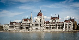 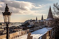 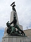 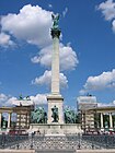  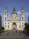 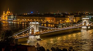 Dari atas, kiri ke kanan: Parlemen Hongaria, Halászbástya, Patung Kebebasan di Bukit Gellért, Alun-Alun Pahlawan di Taman Kota, Teater Nasional, Basilika Santo István dan Belváros dengan Jembatan Rantai Széchenyi pada malam hari | |
| Julukan: Jantung Eropa, Ratu Donau, Mutiara Donau, Ibu Kota Kebebasan, Ibu Kota Spa dan Pemandian Air Panas, Ibu Kota Festival | |
| Koordinat: 47°29′33″N 19°03′05″E / 47.49250°N 19.05139°EKoordinat: 47°29′33″N 19°03′05″E / 47.49250°N 19.05139°E | |
| Negara | |
| Region | Hongaria Tengah |
| Penyatuan Buda, Pest dan Óbuda | 17 November 1873 |
| Jumlah satuan pemerintahan | 23 distrik
|
| Pemerintahan | |
| • Jenis | Wali Kota - Dewan |
| • Badan | Majelis Umum Budapest |
| • Wali Kota | István Tarlós (independen, didukung oleh Fidesz) |
| Luas | |
| • Kota | 525,2 km2 (202,8 sq mi) |
| • Luas perkotaan | 2.538 km2 (980 sq mi) |
| • Luas metropolitan | 7.626 km2 (2,944 sq mi) |
| Ketinggian | Paling rendah (Donau) 96 m Paling tinggi (Bukit János) 527 m m (315 hingga 1,729 ft) |
| Populasi | |
| • Kota | 1,779,361[1] |
| • Peringkat | 1st (10th in EU) |
| • Kepadatan | 3.351/km2 (8,680/sq mi) |
| • Perkotaan | 2,947,722[4] |
| • Metropolitan | 3,303,786 |
| Demonim | Budapester, budapesti (bahasa Hongaria) |
| GDP/GVA PPP (2016) | |
| • Jumlah | $113,1 miliar / €103.8 miliar[8][9] |
| • Per kapita | $64.283 / €58.975[10] |
| PDB PPP (Metro) (2016) | |
| • Jumlah | $141 miliar / €129,4 miliar |
| • Per kapita | $42.678 / €39.169 |
| Zona waktu | UTC+1 (CET) |
| • Musim panas (DST) | UTC+2 (CEST) |
| Kode pos | 1011–1239 |
| Kode area telepon | 1 |
| Kode ISO 3166 | HU-BU |
| Kode NUTS | HU101 |
| Situs web | BudapestInfo Official Government Official |
| Nama resmi | Budapest, termasuk Tepi Sungai Donau, Kastil Buda dan Jalan Andrássy |
| Kriteria | Budaya: ii, iv |
| Nomor identifikasi | 400 |
| Pengukuhan | 1987 (Sesi ke-11) |
| Perluasan | 2002 |
| Luas | 473.3 ha |
| Zona pembatas | 493.8 ha |
Budapest adalah ibukota Hongaria. Kota seluas 525,16 km² ini berpenduduk 1.695.000 jiwa (2005) dan dibagi menjadi 23 distrik.
Kota ini merupakan penggabungan yang dilakukan pada tahun 1873 terhadap dua kota bersebelahan, Obuda (sisi barat) dan Pest (sisi timur), namun terpisah oleh Sungai Donau.
Kota Budapest adalah sebuah warisan dunia yang dilindungi oleh UNESCO mulai tahun 1987.
Catatan kaki
- ^ "Population by type of settlement – annually". Hungarian Central Statistical Office. 12 April 2016. Diakses tanggal 12 April 2016.
- ^ "The Municipality of Budapest (official)". Municipality of Budapest. 11 September 2014. Diakses tanggal 11 September 2014.
- ^ "Budapest". 2014 Encyclopædia Britannica, Inc. 11 September 2014. Diakses tanggal 11 September 2014.
- ^ "Functional Urban Areas – Population on 1 January by age groups and sex". Eurostat. 1 April 2016. Diakses tanggal 12 April 2016.
- ^ "Best view in Budapest from the city's highest hilltop". stay.com – Budapest. 11 September 2014. Diarsipkan dari versi asli tanggal 23 June 2010. Diakses tanggal 11 September 2014.
- ^ "Gazetteer of Hungary, Hungarian Central Statistical Office, 2012" (PDF). Diakses tanggal 2 October 2013.
- ^ "Budapest City Review". Euromonitor International. December 2017. Diakses tanggal 8 May 2014.
- ^ "English: 39,8% of the country's GDP produced in Budapest. Hungary's GDP PPP in 2017 is $284.266 billion (IMF) x 39,8% = $113.1 billion". portfolio.hu / Hungarian Central Statistical Office. Diakses tanggal 17 June 2017.
- ^ Ed F. Nozeman; Arno J. Van der Vlist (2014). European Metropolitan Commercial Real Estate Markets. Springer. hlm. 169. ISBN 978-3-642-37852-2.
- ^ "English: 39,8% of the country's GDP produced in Budapest. Hungary's GDP PPP in 2017 is $284.266 billion (IMF) x 39,8% = $113.1 billion / Budapest pop. 2016 (1.759.407) = $64,283". portfolio.hu / Hungarian Central Statistical Office. Diakses tanggal 17 June 2017.
Pranala luar
Wikimedia Commons memiliki media mengenai Category:Budapest.
Wikivoyage memiliki panduan wisata Budapest.
- (Inggris) Budapest information portal
- (Inggris) Hungary Tourism
- Info Budapest
- Information portal about Budapest
- (Inggris) Budapest and Hungary Travel Guide
- (Inggris) Worldguide by Lonely Planet
- (Inggris) Kota Budapest - situs warisan dunia
- (Inggris) Budapest.hu
- (Inggris) Budapest pages


