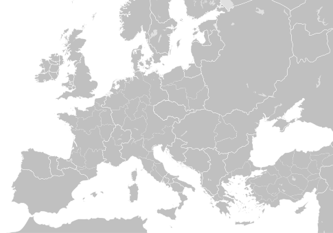
Berkas:Blank map of Europe 1000.svg

Ukuran asli (Berkas SVG, secara nominal 485 × 340 piksel, besar berkas: 1,26 MB)
Berkas ini berasal dari Wikimedia Commons dan mungkin digunakan oleh proyek-proyek lain. Deskripsi dari halaman deskripsinya ditunjukkan di bawah ini.
Ringkasan
Lisensi
- Anda diizinkan:
- untuk berbagi – untuk menyalin, mendistribusikan dan memindahkan karya ini
- untuk menggubah – untuk mengadaptasi karya ini
- Berdasarkan ketentuan berikut:
- atribusi – Anda harus mencantumkan atribusi yang sesuai, memberikan pranala ke lisensi, dan memberi tahu bila ada perubahan. Anda dapat melakukannya melalui cara yang Anda inginkan, namun tidak menyatakan bahwa pemberi lisensi mendukung Anda atau penggunaan Anda.
- berbagi serupa – Apabila Anda menggubah, mengubah, atau membuat turunan dari materi ini, Anda harus menyebarluaskan kontribusi Anda di bawah lisensi yang sama seperti lisensi pada materi asli.
Captions
Items portrayed in this file
menggambarkan
22 Mei 2016
image/svg+xml
checksum Inggris
7ddfdc8ea984e7fa029de4af212334f3ce266bca
1.317.357 Bita
340 piksel
485 piksel
Riwayat berkas
Klik pada tanggal/waktu untuk melihat berkas ini pada saat tersebut.
| Tanggal/Waktu | Miniatur | Dimensi | Pengguna | Komentar | |
|---|---|---|---|---|---|
| terkini | 24 Mei 2016 23.25 |  | 485 × 340 (1,26 MB) | Alphathon | Fixed Byzantine Empire grouping |
| 22 Mei 2016 20.34 |  | 485 × 340 (1,25 MB) | Alphathon | Corrected status of Bohemia | |
| 22 Mei 2016 18.16 |  | 485 × 340 (1,23 MB) | Alphathon | Split Capua from Benevento and removed both from HRE, along with Spoleto | |
| 22 Mei 2016 16.39 |  | 485 × 340 (1,23 MB) | Alphathon | Added welsh kingdoms/principalities and removed Rügen from the HRE | |
| 22 Mei 2016 05.34 |  | 485 × 340 (1,23 MB) | Alphathon | Minor corrections | |
| 22 Mei 2016 04.56 |  | 485 × 340 (1,22 MB) | Alphathon | {{Information |Description={{en|A blank map of Europe circa 1000 CE. The main subdivisions of the Byzantine Empire, Holy Roman Empire, Burgundy, France and Poland are also shown.}} |Source= {{Derived from|Blank_map_of_Europe.svg|display=50}} '''Data s... |
Penggunaan berkas
Tidak ada halaman yang menggunakan berkas ini.
Metadata
Berkas ini mengandung informasi tambahan yang mungkin ditambahkan oleh kamera digital atau pemindai yang digunakan untuk membuat atau mendigitalisasi berkas. Jika berkas ini telah mengalami modifikasi, rincian yang ada mungkin tidak secara penuh merefleksikan informasi dari gambar yang sudah dimodifikasi ini.
| Judul singkat | Europe circa 1000 CE |
|---|---|
| Judul gambar | A blank map of Europe circa 1000 CE. The main subdivisions of the Byzantine Empire, Holy Roman Empire, Burgundy, France and Poland are also shown.
Released under CreativeCommons Attribution-ShareAlike 4.0 (CC BY-SA 4.0; https://creativecommons.org/licenses/by-sa/4.0/) by Wikimedia Commons user Alphathon (https://commons.wikimedia.org/wiki/User:Alphathon) The map is based on https://commons.wikimedia.org/wiki/File:Blank_map_of_Europe.svg. The metadata description for that file is contained at the end of this file's metadata description. Most of the data is derived from a map created by William Robert Shepherd, which is now in the public domain. The source scan can be found at https://commons.wikimedia.org/wiki/File:Europe_byzantine_empires.jpg Detail within the German Kingdom and surrounding areas is from a map found in Professor G. Droysens Allgemeiner Historischer Handatlas, which was published in 1886 by R. Andrée Plate, and is now in the public domain. The source scan can be found at https://commons.wikimedia.org/wiki/File:Droysens-22-23.jpg. Data for the Irish kingdoms is derived from the public domain map https://commons.wikimedia.org/wiki/File:Www.wesleyjohnston.com-users-ireland-maps-historical-map1014.gif Data for the Welsh kingdoms from https://commons.wikimedia.org/wiki/File:Wales_986-99_(Maredudd_ab_Owain).svg Metadata from https://commons.wikimedia.org/wiki/File:Blank_map_of_Europe.svg : A blank map of Europe. Every country has an id which is its ISO-3166-1-ALPHA2 code in lower case. Members of the EU have a class="eu", countries in europe (which I found turkey to be but russia not) have a class="europe". Certain countries are further subdivided the United Kingdom has gb-gbn for Great Britain and gb-nir for Northern Ireland. Russia is divided into ru-kgd for the Kaliningrad Oblast and ru-main for the Main body of Russia. There is the additional grouping #xb for the "British Islands" (the UK with its Crown Dependencies - Jersey, Guernsey and the Isle of Man) and the Kingdom of Denmark (Denmark, Faroe Islands, Greenland) Contributors. Original Image: (http://commons.wikimedia.org/wiki/Image:Europe_countries.svg) Júlio Reis (http://commons.wikimedia.org/wiki/User:Tintazul). Recolouring and tagging with country codes: Marian "maix" Sigler (http://commons.wikimedia.org/wiki/User:Maix) Improved geographical features: http://commons.wikimedia.org/wiki/User:W!B: Updated to reflect dissolution of Serbia & Montenegro: http://commons.wikimedia.org/wiki/User:Zirland Updated to include British Crown Dependencies as seperate entities and regroup them as "British Islands", with some simplifications to the XML and CSS: James Hardy (http://commons.wikimedia.org/wiki/User:MrWeeble) Validated (http://commons.wikimedia.org/wiki/User:CarolSpears) Changed the country code of Serbia to RS per http://en.wikipedia.org/wiki/Serbian_country_codes and the file http://www.iso.org/iso/iso3166_en_code_lists.txt (http://commons.wikimedia.org/wiki/User:TimothyBourke) Uploaded on behalf of User:Checkit, direct complaints to him plox: 'Moved countries out of the "outlines" group, removed "outlines" style class, remove separate style information for Russia' (http://commons.wikimedia.org/wiki/User:Collard) Updated various coastlines and boarders and added various islands not previously shown (details follow). Added Kosovo, Northern Cyprus, Crimea, Abkhazia, South Ossetia, Transnistria and Nagorno-Karabakh as disputed territories. Moved major lakes to their own object and added more. List of updated boarders/coastlines: British Isles (+ added Isle of Wight, Skye, various smaller islands), the Netherlands, Germany, Austria, Hungary, Czech Republic, Denmark, Sweden, Finland, Poland, Kaliningrad Oblast of the Russian Federation (and minor tweaks to Lithuania), Estonia, Ukraine, Moldova (minor), Romania, Bulgaria, Turkey, Greece, F.Y.R. Macedonia, Serbia, Bosnia and Herzegovina, Montenegro, Albania, Croatia, Italy (mainland and Sicily), Malta (http://commons.wikimedia.org/wiki/User:Alphathon). Added Bornholm (http://commons.wikimedia.org/wiki/User:Heb)Released under CreativeCommons Attribution ShareAlike (http://creativecommons.org/licenses/by-sa/2.5/). |
| Lebar | 485 |
| Tinggi | 340 |


