
Berkas:Tupaia's map, c. 1769.jpg

Ukuran pratayang ini: 800 × 538 piksel. Resolusi lainnya: 320 × 215 piksel | 640 × 430 piksel | 1.024 × 688 piksel | 1.280 × 860 piksel | 2.560 × 1.720 piksel | 7.657 × 5.145 piksel.
Ukuran asli (7.657 × 5.145 piksel, ukuran berkas: 15,67 MB, tipe MIME: image/jpeg)
Ringkasan
| Seniman/Pembuat |
James Cook |
| Deskripsi |
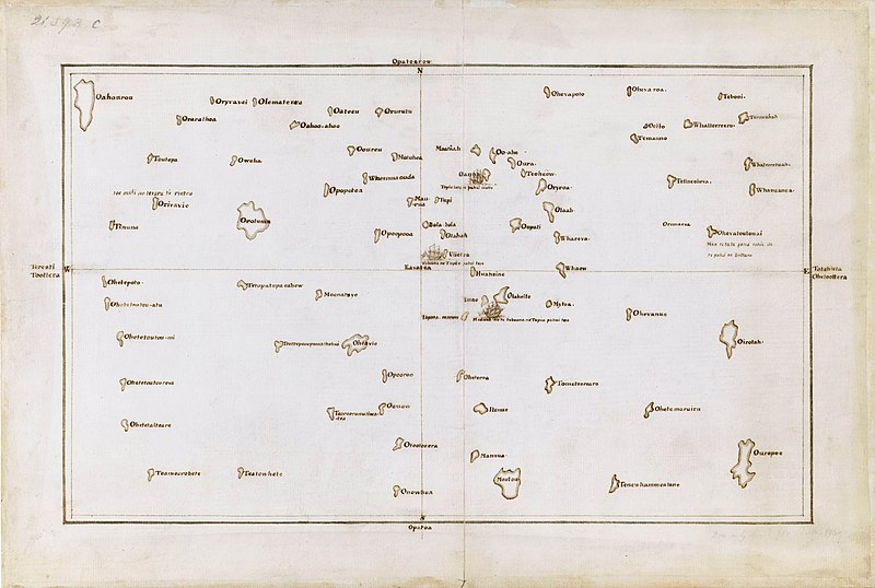
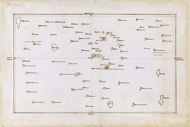
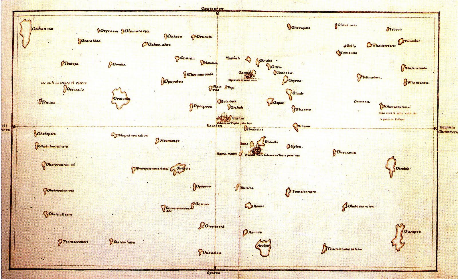
English: Tupaia's chart of the islands surrounding Tahiti in Oceania |
| Tanggal | circa 1769 |
| Kode inventaris |
Add MS 21593 C |
| Referensi | The Society Islands |
| Sumber/Fotografer |
British Library, London. |
Lisensi
|
Ini adalah suatu perbanyakan fotografis dari sebuah karya seni dua dimensi. Karya seni tersebut berada pada domain publik karena alasan berikut:
Posisi resmi Wikimedia Foundation adalah bahwa "faithful reproductions of two-dimensional public domain works of art are public domain, and that claims to the contrary represent an assault on the very concept of a public domain". Untuk detilnya, lihat Commons:When to use the PD-Art tag.
Oleh karena itu, perbanyakan fotografis ini juga dianggap berada pada domain publik. Mohon diperhatikan bahwa hukum lokal mungkin saja melarang atau membatasi penggunaan kembali berkas ini di wilayah hukum anda. Lihat Commons:Reuse of PD-Art photographs. | ||||
Riwayat berkas
Klik pada tanggal/waktu untuk melihat berkas ini pada saat tersebut.
| Tanggal/Waktu | Miniatur | Dimensi | Pengguna | Komentar | |
|---|---|---|---|---|---|
| terkini | 23 September 2021 02.03 | | 7.657 × 5.145 (15,67 MB) | Capmo | Cropped 4 % horizontally, 6 % vertically using CropTool with lossless mode. |
| 7 Desember 2019 00.15 |  | 8.000 × 5.484 (15,06 MB) | Adjutor | Newer image from the British Library https://www.bl.uk/collection-items/the-society-islands accessed 07 December 2019. Format - Pen and Ink, Map; Creator - James Cook, Tupaia Add. MS 21593 C; Created 1769 "This is a view of the Society Islands by Captain James Cook, who completed his first exploration of the Pacific Ocean from 1769 to 1771. The chart is a copy of an original document by Tupaia, a priest and leader of the island of Ra’iatea. He was enlisted by Cook to navigate HMS Endeavour to... | |
| 16 Maret 2017 02.50 |  | 1.600 × 975 (371 KB) | KAVEBEAR | ||
| 16 Maret 2017 02.46 |  | 801 × 488 (84 KB) | KAVEBEAR |
Penggunaan berkas
Halaman berikut menggunakan berkas ini:
Penggunaan berkas global
Wiki lain berikut menggunakan berkas ini:
- Penggunaan pada de.wikipedia.org
- Penggunaan pada en.wikipedia.org
- Penggunaan pada es.wikipedia.org
- Penggunaan pada it.wikipedia.org
- Penggunaan pada no.wikipedia.org
- Penggunaan pada zh.wikipedia.org