
Berkas:Map of the Arctic region showing the Northeast Passage, the Northern Sea Route and Northwest Passage, and bathymetry.png

Ukuran pratayang ini: 632 × 600 piksel. Resolusi lainnya: 253 × 240 piksel | 506 × 480 piksel | 1.003 × 952 piksel.
Ukuran asli (1.003 × 952 piksel, ukuran berkas: 758 KB, tipe MIME: image/png)
Ringkasan
| Deskripsi |
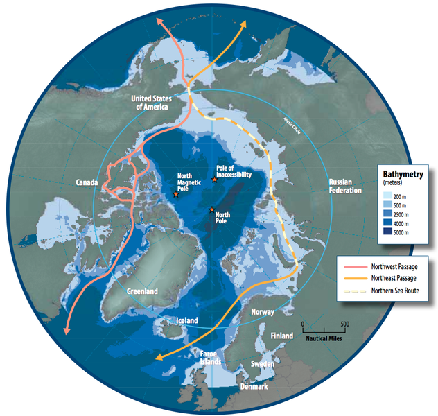
English: Map of the Arctic region showing shipping routes Northeast Passage, Northern Sea Route, and Northwest Passage, and bathymetry |
| Tanggal | |
| Sumber | Arctic Council - Arctic marine shipping assessment - http://www.arctic.noaa.gov/detect/documents/AMSA_2009_Report_2nd_print.pdf |
| Pembuat | Susie Harder |
Lisensi
This file is in the public domain because the work was created/published by the Arctic Council, an international organization
|
Riwayat berkas
Klik pada tanggal/waktu untuk melihat berkas ini pada saat tersebut.
| Tanggal/Waktu | Miniatur | Dimensi | Pengguna | Komentar | |
|---|---|---|---|---|---|
| terkini | 19 Oktober 2014 16.46 | | 1.003 × 952 (758 KB) | Al83tito | User created page with UploadWizard |
Penggunaan berkas
Halaman berikut menggunakan berkas ini:
Penggunaan berkas global
Wiki lain berikut menggunakan berkas ini:
- Penggunaan pada bn.wikipedia.org
- Penggunaan pada de.wikipedia.org
- Penggunaan pada en.wikipedia.org
- Penggunaan pada es.wikipedia.org
- Penggunaan pada fa.wikipedia.org
- Penggunaan pada fr.wikipedia.org
- Penggunaan pada he.wikipedia.org
- Penggunaan pada hr.wikipedia.org
- Penggunaan pada hu.wikipedia.org
- Penggunaan pada it.wikipedia.org
- Penggunaan pada ja.wikipedia.org
- Penggunaan pada ko.wikipedia.org
- Penggunaan pada nl.wikipedia.org
- Penggunaan pada pl.wikipedia.org
- Penggunaan pada pt.wikipedia.org
- Penggunaan pada ru.wikipedia.org
- Penggunaan pada sd.wikipedia.org
- Penggunaan pada te.wikipedia.org
- Penggunaan pada th.wikipedia.org
- Penggunaan pada tr.wikipedia.org