
Berkas:Java-Map.jpg
Ukuran asli (3.000 × 2.088 piksel, ukuran berkas: 1,12 MB, tipe MIME: image/jpeg)
Ringkasan
| Deskripsi |
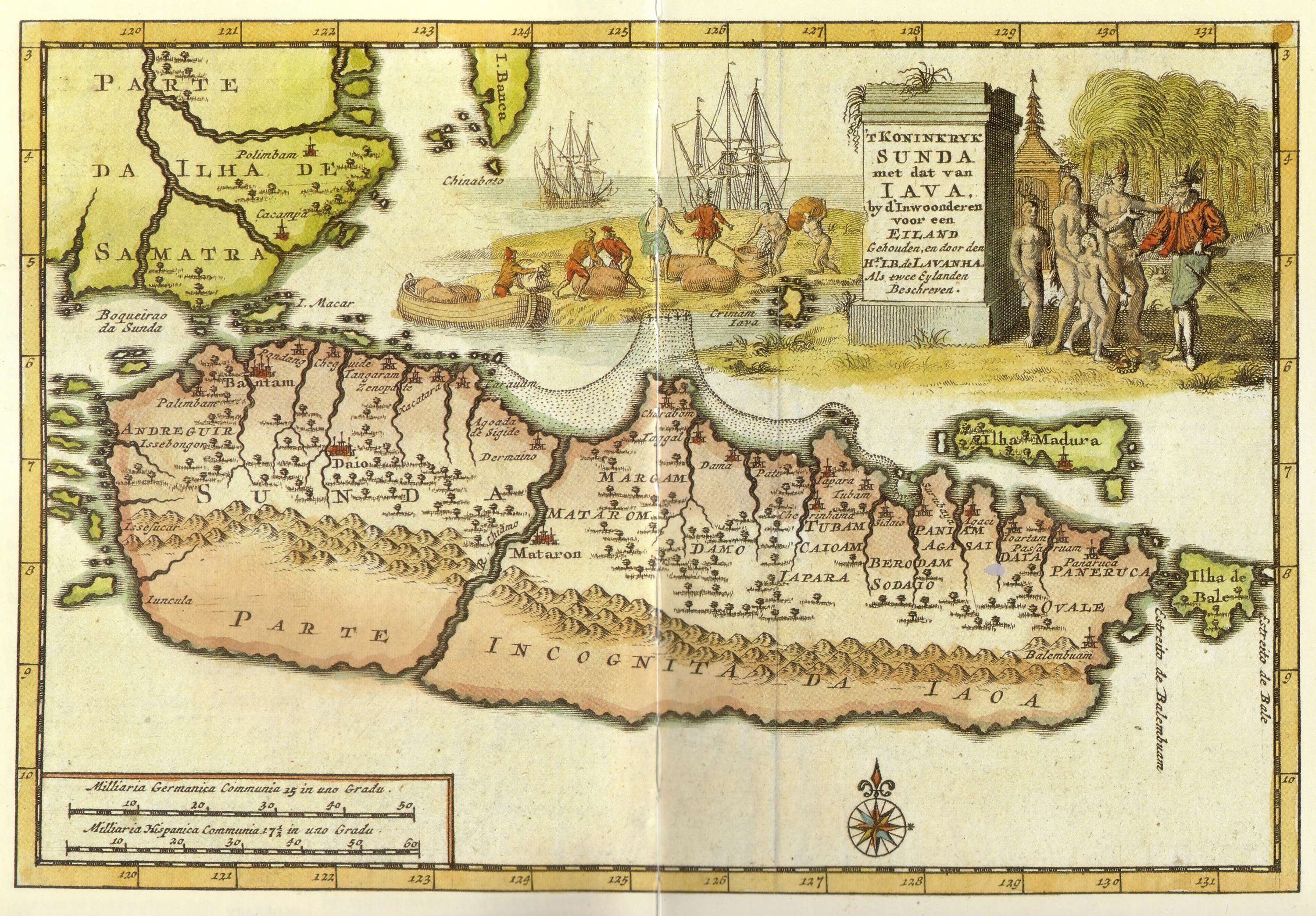
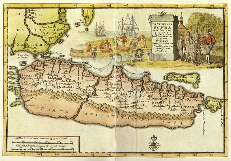
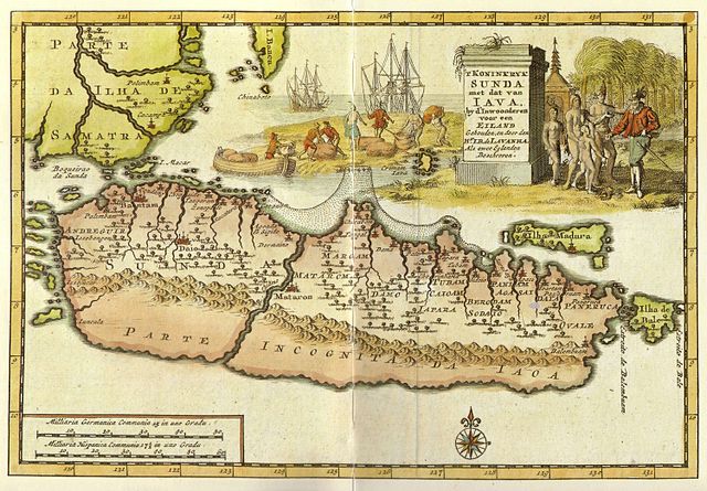
Kingdom of Sunda and Java as two islands. The toponym includes: |
| Tanggal | early 18 century |
| Sumber | from "Java" - Periplus Adventure Guide. Periplus Editions 1997. ISBN 962-593-244-5 |
| Pembuat |
Pieter van der Aa (1659-1733) Hr. L. B. de Lavanha |
| Versi lainnya |
|

| Lokasi kamera | | Lihat gambar ini dan gambar di sekitarnya di: OpenStreetMap |
|---|
Lisensi
|
This work is in the public domain in its country of origin and other countries and areas where the copyright term is the author's life plus 70 years or fewer.
| |
| Berkas ini telah diidentifikasi bebas dari pembatasan menurut hukum hak cipta termasuk semua hak terkait dan relevan. | |
Riwayat berkas
Klik pada tanggal/waktu untuk melihat berkas ini pada saat tersebut.
| Tanggal/Waktu | Miniatur | Dimensi | Pengguna | Komentar | |
|---|---|---|---|---|---|
| terkini | 20 Januari 2008 12.12 | | 3.000 × 2.088 (1,12 MB) | Merbabu~commonswiki | {{Information |Description=Early 18th century Dutch map. |Source= |Date=early 18th century |Author= |Permission= |other_versions= }} |
Penggunaan berkas
Halaman berikut menggunakan berkas ini:
Penggunaan berkas global
Wiki lain berikut menggunakan berkas ini:
- Penggunaan pada ar.wikipedia.org
- Penggunaan pada ca.wikipedia.org
- Penggunaan pada en.wikipedia.org
- Penggunaan pada fr.wikipedia.org
- Penggunaan pada hr.wikipedia.org
- Penggunaan pada it.wikipedia.org
- Penggunaan pada ja.wikipedia.org
- Penggunaan pada mk.wikipedia.org
- Penggunaan pada mt.wikipedia.org
- Penggunaan pada nl.wikipedia.org
- Penggunaan pada pl.wikipedia.org
- Penggunaan pada pnb.wikipedia.org
- Penggunaan pada ru.wikipedia.org
- Penggunaan pada ur.wikipedia.org
- Penggunaan pada zh.wikipedia.org