
Berkas:Jangchung Catholic Church (15524500676).jpg

Ukuran pratayang ini: 337 × 600 piksel. Resolusi lainnya: 135 × 240 piksel | 269 × 480 piksel | 431 × 768 piksel | 575 × 1.024 piksel | 1.151 × 2.048 piksel | 2.760 × 4.912 piksel.
Ukuran asli (2.760 × 4.912 piksel, ukuran berkas: 3,54 MB, tipe MIME: image/jpeg)
Ringkasan
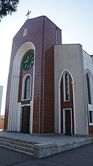
| Deskripsi | Pyongyang North Korea DPRK |
| Tanggal | |
| Sumber | Jangchung Catholic Church |
| Pembuat | Uri Tours |
| Lokasi objek | | Lihat gambar ini dan gambar di sekitarnya di: OpenStreetMap |
|---|
| Lokasi kamera | | Lihat gambar ini dan gambar di sekitarnya di: OpenStreetMap |
|---|
Lisensi
This file was provided to Wikimedia Commons by Uri Tours and is copyrighted.
This file is verified as being licenced under an appropriate Creative Commons licence. In short: you are free to modify the file as long as you attribute Uri Tours (uritours.com) and distribute it under the same licence. Failure to attribute as per this requirement constitutes copyright infringement. This tag does not indicate the copyright status of the attached work. A normal copyright tag is still required. See Commons:Licensing.
|
Berkas ini dilisensikan di bawah lisensi Creative Commons Atribusi-Berbagi Serupa 2.0 Generik
Atribusi: Uri Tours (uritours.com)
- Anda diizinkan:
- untuk berbagi – untuk menyalin, mendistribusikan dan memindahkan karya ini
- untuk menggubah – untuk mengadaptasi karya ini
- Berdasarkan ketentuan berikut:
- atribusi – Anda harus mencantumkan atribusi yang sesuai, memberikan pranala ke lisensi, dan memberi tahu bila ada perubahan. Anda dapat melakukannya melalui cara yang Anda inginkan, namun tidak menyatakan bahwa pemberi lisensi mendukung Anda atau penggunaan Anda.
- berbagi serupa – Apabila Anda menggubah, mengubah, atau membuat turunan dari materi ini, Anda harus menyebarluaskan kontribusi Anda di bawah lisensi yang sama seperti lisensi pada materi asli.
| This image was originally posted to Flickr by northkoreatravel at https://www.flickr.com/photos/103743993@N04/15524500676. It was reviewed on 27 Oktober 2014 by FlickreviewR and was confirmed to be licensed under the terms of the cc-by-sa-2.0. |
The depicted structure situated in or visible from public space (e.g. a building, a bridge, an overpass) in
|
 |

.jpg)
.jpg¶ms=039.006840_N_0125.778280_E_globe:Earth_class:object_type:object__&language=id)
.jpg¶ms=039.006890_N_0125.778430_E_globe:Earth_type:camera__&language=id)
Riwayat berkas
Klik pada tanggal/waktu untuk melihat berkas ini pada saat tersebut.
| Tanggal/Waktu | Miniatur | Dimensi | Pengguna | Komentar | |
|---|---|---|---|---|---|
| terkini | 27 Oktober 2014 23.33 | | 2.760 × 4.912 (3,54 MB) | Russavia | Transferred from Flickr via Flickr2commons |
Penggunaan berkas
2 halaman berikut menggunakan berkas ini:
Penggunaan berkas global
Wiki lain berikut menggunakan berkas ini:
- Penggunaan pada arz.wikipedia.org
- Penggunaan pada ca.wikipedia.org
- Penggunaan pada ceb.wikipedia.org
- Penggunaan pada cs.wikipedia.org
- Penggunaan pada de.wikipedia.org
- Penggunaan pada en.wikipedia.org
- Penggunaan pada es.wikipedia.org
- Penggunaan pada fr.wikipedia.org
- Penggunaan pada hi.wikipedia.org
- Penggunaan pada it.wikipedia.org
- Penggunaan pada ja.wikipedia.org
- Penggunaan pada ko.wikipedia.org
- Penggunaan pada nl.wikipedia.org
- Penggunaan pada no.wikipedia.org
- Penggunaan pada pl.wikipedia.org
- Penggunaan pada pt.wikipedia.org
- Penggunaan pada ru.wikipedia.org
- Penggunaan pada sl.wikipedia.org
- Penggunaan pada th.wikipedia.org
- Penggunaan pada uk.wikipedia.org
- Penggunaan pada vi.wikipedia.org
- Penggunaan pada www.wikidata.org
- Penggunaan pada zh.wikipedia.org
.jpg)