
Berkas:Constanta romania.jpg
Ukuran pratayang ini: 395 × 599 piksel. Resolusi lainnya: 158 × 240 piksel | 316 × 480 piksel | 506 × 768 piksel | 675 × 1.024 piksel | 2.000 × 3.032 piksel.
Ukuran asli (2.000 × 3.032 piksel, ukuran berkas: 2,11 MB, tipe MIME: image/jpeg)
| Deskripsi |
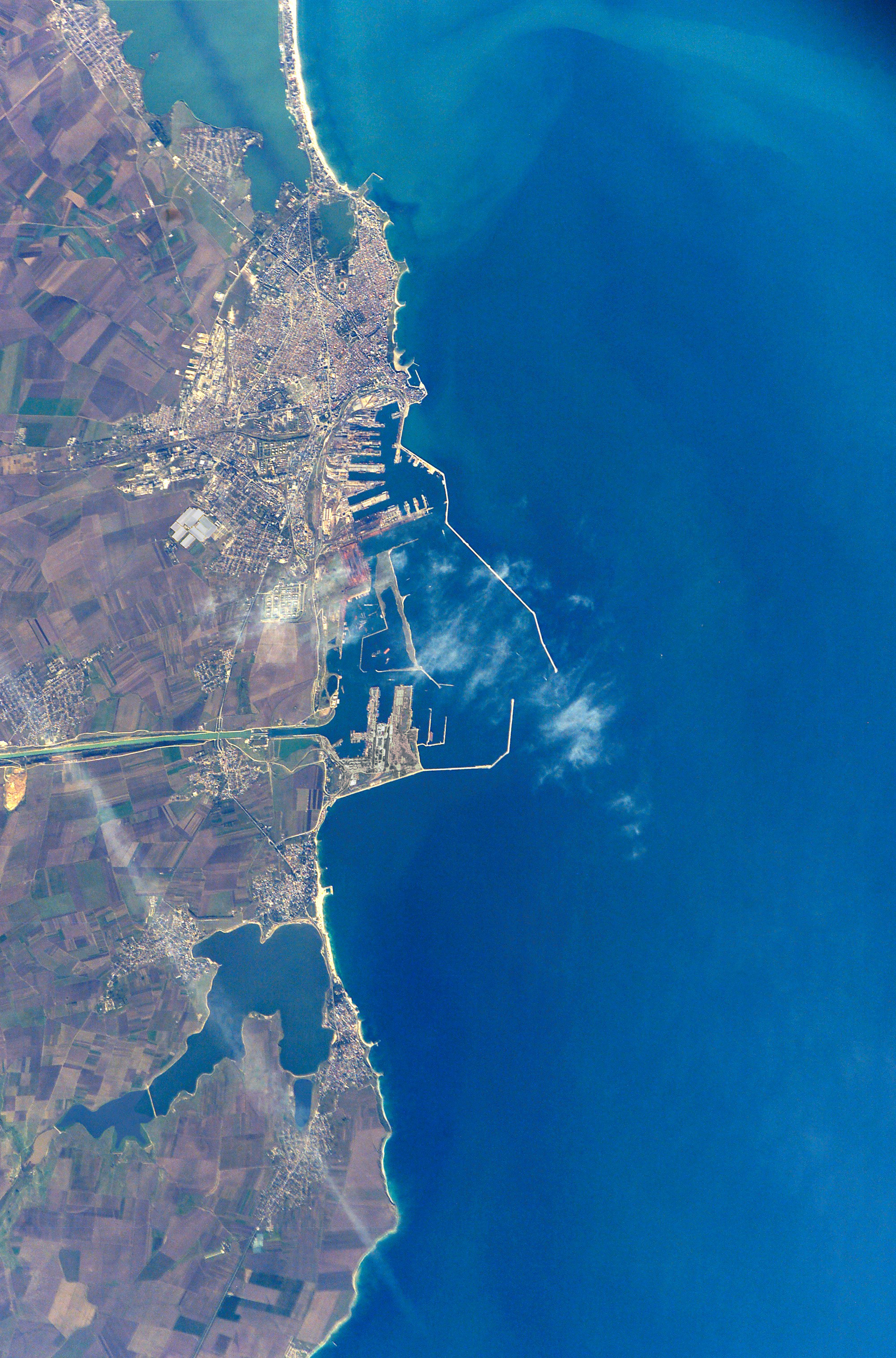
English: The modern city of Constanţa, with a population of more than 348,000, is located on the western coast of the Black Sea and is the principal seaport for Romania. It is the site of the ancient Greek city of Tomis, colonized in the 6th century B.C. In the 1st century A.D. Tomis became a flourishing provincial capital of the Roman Empire when it acquired its current name from the emperor Constantine I. Today, Constanta is a thriving port-of-entry for Romania, offering both tourist attractions and an expanding, modern port facility that is among the largest on the Black Sea. The crew of STS-112 acquired this detailed digital image of the city on October 17, 2002, using a 400-mm lens. The older part of the city is situated near the large coastal lagoon to the north, while to the south the port facilities are connected to the Danube River’s import shipping commerce via the 64-km Danube – Black Sea Canal. Agricultural fields of mostly wheat and barley extend almost to the shorelines. |
|||||
| Tanggal | ||||||
| Sumber | NASA - Earth From Space | |||||
| Pembuat | NASA - Earth From Space | |||||
| Izin (Menggunakan kembali berkas ini) |
|

| Lokasi kamera | | Lihat gambar ini dan gambar di sekitarnya di: OpenStreetMap |
|---|
Riwayat berkas
Klik pada tanggal/waktu untuk melihat berkas ini pada saat tersebut.
| Tanggal/Waktu | Miniatur | Dimensi | Pengguna | Komentar | |
|---|---|---|---|---|---|
| terkini | 9 Januari 2017 15.55 | | 2.000 × 3.032 (2,11 MB) | Julieta39 | contrast |
| 7 Oktober 2008 04.42 |  | 2.000 × 3.032 (1,71 MB) | Kimse | Larger resolution from the same source | |
| 19 Juni 2006 16.25 |  | 540 × 768 (249 KB) | Darwinek |
Penggunaan berkas
2 halaman berikut menggunakan berkas ini:
Penggunaan berkas global
Wiki lain berikut menggunakan berkas ini:
- Penggunaan pada bg.wikipedia.org
- Penggunaan pada ca.wikipedia.org
- Penggunaan pada de.wikipedia.org
- Penggunaan pada en.wikipedia.org
- Penggunaan pada fr.wikipedia.org
- Penggunaan pada hu.wikipedia.org
- Penggunaan pada mk.wikipedia.org
- Penggunaan pada ro.wikipedia.org
- Penggunaan pada ru.wikipedia.org
- Penggunaan pada sq.wikipedia.org
- Penggunaan pada sr.wikipedia.org
- Penggunaan pada tr.wikipedia.org
- Penggunaan pada uk.wikipedia.org
- Penggunaan pada ur.wikipedia.org
- Penggunaan pada zh.wikipedia.org