
Berkas:Asker Line map.jpg
Ukuran pratayang ini: 800 × 512 piksel. Resolusi lainnya: 320 × 205 piksel | 640 × 410 piksel | 898 × 575 piksel.
Ukuran asli (898 × 575 piksel, ukuran berkas: 129 KB, tipe MIME: image/jpeg)
| Deskripsi |
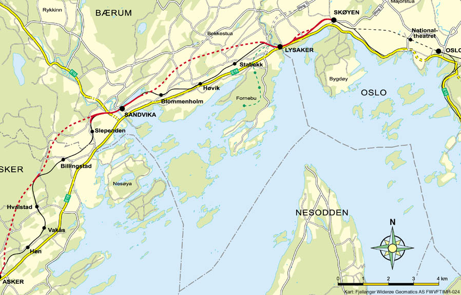
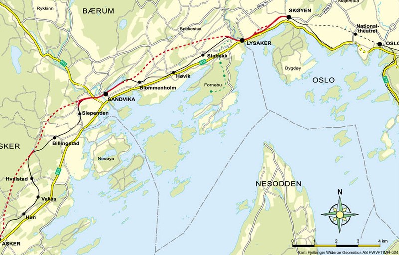
English: Map of the Asker Line west of Oslo, Norway. Red line is the Asker Line and black line is the Drammen Line. Dotted lines are tunnels. Black dots are stations. The green line is the Fornebu Line. The yellow lines indicate European Routes E16 and E18. |
|||
| Sumber | http://www.jernbaneverket.no/multimedia/archive/01417/Kart_Sk_yen-Asker_1417793a.jpg | |||
| Pembuat | Jernbaneverket / Norwegian National Rail Administration | |||
| Izin (Menggunakan kembali berkas ini) |
|


Riwayat berkas
Klik pada tanggal/waktu untuk melihat berkas ini pada saat tersebut.
| Tanggal/Waktu | Miniatur | Dimensi | Pengguna | Komentar | |
|---|---|---|---|---|---|
| terkini | 7 Mei 2020 10.56 | | 898 × 575 (129 KB) | Tholme | Cropped 3 % horizontally, 5 % vertically using CropTool with lossless mode. Remove border |
| 18 November 2008 18.58 |  | 926 × 603 (136 KB) | Arsenikk | {{Information |Description={{en|1=Map of the Asker Line west of Oslo, Norway. Red line is the Asker Line and black line is the Drammen Line. Dotted lines are tunnels. Black dots are stati |
Penggunaan berkas
Halaman berikut menggunakan berkas ini:
Penggunaan berkas global
Wiki lain berikut menggunakan berkas ini:
- Penggunaan pada da.wikipedia.org
- Penggunaan pada de.wikipedia.org
- Penggunaan pada en.wikipedia.org
- Penggunaan pada fr.wikipedia.org
- Penggunaan pada nl.wikipedia.org
- Penggunaan pada nn.wikipedia.org
- Penggunaan pada no.wikipedia.org
- Penggunaan pada pl.wikipedia.org
- Penggunaan pada sv.wikipedia.org
- Penggunaan pada www.wikidata.org