
Berkas:1-flores-1725.jpg

Ukuran pratayang ini: 800 × 572 piksel. Resolusi lainnya: 320 × 229 piksel | 640 × 458 piksel | 1.000 × 715 piksel.
Ukuran asli (1.000 × 715 piksel, ukuran berkas: 117 KB, tipe MIME: image/jpeg)
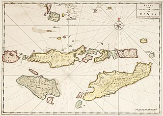
Ringkasan
| Deskripsi |
English: Map of the Flores Islands 1725. Note: Antique map of Sumba, Flores and Timor and Part of Banda, Indonesia. |
| Tanggal | circa 1725 |
| Sumber | https://www.1stdibs.com/furniture/more-furniture-collectibles/collectibles-curiosities/maps/antique-map-sumba-flores-timor-part-banda-indonesia-1726/id-f_26936272/ |
| Pembuat | Uploader Blackman Jr. |
Lisensi
|
This work is in the public domain in its country of origin and other countries and areas where the copyright term is the author's life plus 100 years or fewer. | |
| Berkas ini telah diidentifikasi bebas dari pembatasan menurut hukum hak cipta termasuk semua hak terkait dan relevan. | |
Riwayat berkas
Klik pada tanggal/waktu untuk melihat berkas ini pada saat tersebut.
| Tanggal/Waktu | Miniatur | Dimensi | Pengguna | Komentar | |
|---|---|---|---|---|---|
| terkini | 13 Agustus 2022 02.10 | | 1.000 × 715 (117 KB) | Blackman Jr. | Uploaded own work with UploadWizard |
Penggunaan berkas
Halaman berikut menggunakan berkas ini: