
San Leonardo, Nueva Ecija

| Data sensus penduduk di San Leonardo | |||
|---|---|---|---|
| Tahun | Populasi | Persentase | |
| 1995 | 46.545 | — | |
| 2000 | 50.478 | 1.76% | |
| 2007 | 54.596 | 1.09% | |
San Leonardo adalah munisipalitas yang terletak di provinsi Nueva Ecija, Filipina.
Pada tahun 2010, munisipalitas ini memiliki populasi sebesar 66.148 jiwa dan 13.148 rumah tangga.
Pembagian wilayah[sunting | sunting sumber]
Secara administratif San Leonardo terbagi menjadi 15 barangay, yaitu:
- Mallorca
- Bonifacio (Población)
- San Bartolomé (Población)
- Burgos (Población)
- Rizal (Población)
- Mambangnan
- Nieves
- Castellano
- San Roque
- San Anton
- Tambo-Adorable
- Magpapalayok
- Tabuating
- Tagumpay
- Diversion
Sarana pendidikan[sunting | sunting sumber]
Sarana pendidikan yang tersedia di San Leonardo antara lain:
- C.I. Villaroman Elementary School (dahulu bernama Magpapalayok Elementary School)
- Castellano Elementary School
- Mallorca Elementary School
- Mambangnan Elementary School
- NievElementary School Elementary School
- San Anton Elementary School
- San Leonardo CS
- San Roque Elementary School
- Tagumpay Elementary School
- Tambo North Elementary School
- Tambo South Elementary School
- Magpapalayok NHS
- Mallorca NHS
- Mambangnan NHS
- San Anton NHS
- Clever Lane Development School
- Cuyapo UMC Learning Center
- L.F. Gonzales College of Science & Technology, Inc (LFGCSTI)
- Dr. Gloria D. Lacson College
- San Leonardo Academy
- San Lorenzo Diocesan Academy
- Seraphin Learning Center
- Trinity Christian School (TCS)
Galeri[sunting | sunting sumber]
-
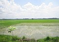 Suasana areal persawahan di San Leonardo, Nueva Ecija

Pranala luar[sunting | sunting sumber]
- The Official Website of San Leonardo, Nueva Ecija Diarsipkan 2010-08-20 di Wayback Machine.
- Pasyalan Nueva Ecija
- Philippine Standard Geographic Code Diarsipkan 2012-04-13 di Wayback Machine.
- 1995 Philippine Census Information Diarsipkan 2011-06-24 di Wayback Machine.
- 2000 Philippine Census Information
- 2007 Philippine Census Information Diarsipkan 2008-11-20 di Wayback Machine.
- Local Governance Performance Management System Diarsipkan 2016-03-04 di Wayback Machine.
Koordinat: 15°22′N 120°58′E / 15.367°N 120.967°E
Artikel bertopik geografi atau tempat Filipina ini adalah sebuah rintisan. Anda dapat membantu Wikipedia dengan mengembangkannya. |