
Berkas:LocationRomanEmpire.png
Ukuran pratayang ini: 800 × 520 piksel. Resolusi lainnya: 320 × 208 piksel | 640 × 416 piksel | 1.084 × 705 piksel.
Ukuran asli (1.084 × 705 piksel, ukuran berkas: 34 KB, tipe MIME: image/png)

|
File:Map of the Roman Empire at its height.svg merupakan versi vektor dari berkas ini. Berkas itu harus digunakan menggantikan gambar raster ini jika kualitasnya tidak rendah.
File:LocationRomanEmpire.png → File:Map of the Roman Empire at its height.svg
Untuk informasi lanjutan, lihat Bantuan:SVG. |
 |
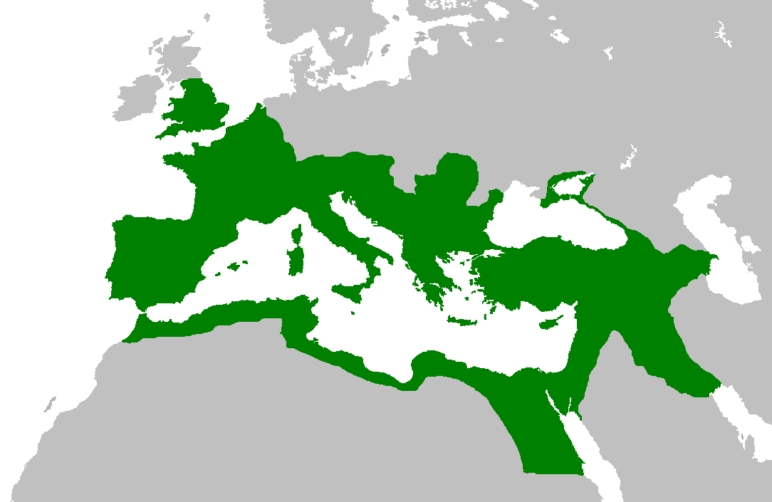
| Deskripsi |
English: Map of the Roman Empire at its height, under Trajan.
Esperanto: Mapo de la Roma Imperio je ĝia plej vasta etendo, sub la imperiestro Trajano.
Español: El Imperio Romano a su máxima extensión, durante el reinado de Trajano.
Suomi: Rooman valtakunta Trajanuksen aikana.
Français : L'Empire romain à son apogée, sous Trajan.
Italiano: Mappa dell'Impero Romano al culmine della sua estensione, sotto Traiano.
日本語: 117年(トラヤヌス帝の時代)のローマ帝国の最大領土
Português: Localização do Império Romano em sua extensão máxima. |
||||||||
| Tanggal | |||||||||
| Sumber | Previous version | ||||||||
| Pembuat | User:Jrockley / User:Kasper Holl | ||||||||
| Izin (Menggunakan kembali berkas ini) |
|
||||||||
| Versi lainnya |
|

Riwayat berkas
Klik pada tanggal/waktu untuk melihat berkas ini pada saat tersebut.
| Tanggal/Waktu | Miniatur | Dimensi | Pengguna | Komentar | |
|---|---|---|---|---|---|
| terkini | 2 Juni 2007 14.44 | | 1.084 × 705 (34 KB) | Medievalista | Ok, sorry, my mistake... here is the new map |
| 2 Juni 2007 14.42 |  | 1.084 × 705 (34 KB) | Medievalista | Update of the previous map: less of teritory in Africa, withdraw in Britain up to the future Hadrianic wall and improve the trace of the Rhine-Danube frontier | |
| 5 Februari 2007 03.45 |  | 1.084 × 705 (35 KB) | Jrockley | lil bit more Africa, lil less Scandinavia | |
| 5 Februari 2007 03.28 |  | 1.259 × 756 (41 KB) | Jrockley | Much larger version, as faithful as possible | |
| 9 Agustus 2005 12.24 |  | 250 × 175 (8 KB) | Kasper Holl | Map of the location of the Roman Empire at its height, under Trajan. Made from the Blank Map World. |
Penggunaan berkas
Tidak ada halaman yang menggunakan berkas ini.
Penggunaan berkas global
Wiki lain berikut menggunakan berkas ini:
- Penggunaan pada en.wikipedia.org
- Penggunaan pada he.wikipedia.org
- Penggunaan pada hy.wikipedia.org
- Penggunaan pada it.wikipedia.org
- Penggunaan pada kk.wikipedia.org