Cotabato Selatan: Perbedaan antara revisi
Konten dihapus Konten ditambahkan
k update |
|||
| Baris 4: | Baris 4: | ||
== Pembagian wilayah == |
== Pembagian wilayah == |
||
Secara administratif provinsi Cotabato Selatan terbagi menjadi 10 [[munisipalitas]], 1 [[kota komponen]] dan 1 [[kota independen]], yaitu: |
|||
<table border="0"><tr> |
|||
<td valign="top"> |
|||
{| class="wikitable sortable" |
|||
* [[Banga, South Cotabato|Banga]] |
|||
|- bgcolor=#cccccc |
|||
* [[Lake Sebu, South Cotabato|Lake Sebu]] |
|||
! colspan=2 | [[Cities of the Philippines|City]]/[[Municipalities of the Philippines|Municipality]] !! No. of<br> [[Barangays]] !! Area<br>(km²) !! Population<br>(2010) !! Pop. density<br />(per km²) !! District !! Class Income !! Classification |
|||
* [[Norala, South Cotabato|Norala]] |
|||
|- |
|||
* [[Polomolok, South Cotabato|Polomolok]] |
|||
|[[Image:Ph Polomolok Seal.png|20px]] |
|||
* [[Santo Niño, South Cotabato|Santo Niño]] |
|||
|[[Polomolok, South Cotabato|Polomolok]] |
|||
</td><td valign="top"> |
|||
|<center>23 |
|||
* [[Surallah, South Cotabato|Surallah]] |
|||
|<center>339.97 |
|||
* [[Tampakan, South Cotabato|Tampakan]] |
|||
|<center>137,821 |
|||
* [[Tantangan, South Cotabato|Tantangan]] |
|||
|<center>405.4 |
|||
* [[T'Boli, South Cotabato|T'Boli]] |
|||
|<center>1st |
|||
* [[Tupi, South Cotabato|Tupi]] |
|||
|<center>1st Class Municipality |
|||
</td></tr></table> |
|||
|<center>Urban |
|||
|- |
|||
| |
|||
|[[Tupi, South Cotabato|Tupi]] |
|||
|<center>15 |
|||
|<center>228.0 |
|||
|<center>59,671 |
|||
|<center>261.7 |
|||
|<center>1st |
|||
|<center>1st Class Municipality |
|||
|<center>Sub-Urban |
|||
|- |
|||
|[[Image:Koronadal logo.jpg|20px]] |
|||
|[[Koronadal]] |
|||
|<center>27 |
|||
|<center>277.0 |
|||
|<center>169,062 |
|||
|<center>610.3 |
|||
|<center>2nd |
|||
|<center>3rd Class City |
|||
|<center>Urban |
|||
|- |
|||
|[[Image:Ph seal gensan.png|20px]] |
|||
|[[General Santos]] |
|||
|<center>26 |
|||
|<center>492.86 |
|||
|<center>679,588 |
|||
|<center>1,378.9 |
|||
|<center>1st |
|||
|<center>Highly Urbanized City |
|||
|<center>Highly Urbanized |
|||
|- |
|||
| |
|||
|[[Banga, South Cotabato|Banga]] |
|||
|<center>22 |
|||
|<center>240.35 |
|||
|<center>76,170 |
|||
|<center>316.9 |
|||
|<center>2nd |
|||
|<center>1st Class Municipality |
|||
|<center>Rural |
|||
|- |
|||
| |
|||
|[[Lake Sebu, South Cotabato|Lake Sebu]] |
|||
|<center>19 |
|||
|<center>891.38 |
|||
|<center>68,148 |
|||
|<center>76.5 |
|||
|<center>2nd |
|||
|<center>2nd Class Municipality |
|||
|<center>Sub-Urban |
|||
|- |
|||
| |
|||
|[[Norala, South Cotabato|Norala]] |
|||
|<center>14 |
|||
|<center>194.40 |
|||
|<center>44,070 |
|||
|<center>226.7 |
|||
|<center>2nd |
|||
|<center>3rd Class Municipality |
|||
|<center>Sub-Urban |
|||
|- |
|||
| |
|||
|[[Santo Niño, South Cotabato|Santo Niño]] |
|||
|<center>10 |
|||
|<center>109.4 |
|||
|<center>39,659 |
|||
|<center>362.5 |
|||
|<center>2nd |
|||
|<center>3rd Class Municipality |
|||
|<center>Rural |
|||
|- |
|||
| |
|||
|[[Surallah, South Cotabato|Surallah]] |
|||
|<center>17 |
|||
|<center>241.00 |
|||
|<center>75,841 |
|||
|<center>314.7 |
|||
|<center>2nd |
|||
|<center>1st Class Municipality |
|||
|<center>Sub-Urban |
|||
|- |
|||
| |
|||
|[[T'Boli, South Cotabato|T'Boli]] |
|||
|<center>25 |
|||
|<center>809.00 |
|||
|<center>70,609 |
|||
|<center>87.3 |
|||
|<center>2nd |
|||
|<center>1st Class Municipality |
|||
|<center>Sub-Urban |
|||
|- |
|||
| |
|||
|[[Tampakan, South Cotabato|Tampakan]] |
|||
|<center>14 |
|||
|<center>242.50 |
|||
|<center>34,245 |
|||
|<center>141.2 |
|||
|<center>1st |
|||
|<center>2nd Class Municipality |
|||
|<center>Rural |
|||
|- |
|||
| |
|||
|[[Tantangan, South Cotabato|Tantangan]] |
|||
|<center>13 |
|||
|<center>126.00 |
|||
|<center>36,798 |
|||
|<center>292.0 |
|||
|<center>2nd |
|||
|<center>3rd Class Municipality |
|||
|<center>Rural |
|||
|} |
|||
== Sarana pendidikan == |
|||
{{Cotabato Selatan}} |
{{Cotabato Selatan}} |
||
Revisi per 18 November 2011 11.50

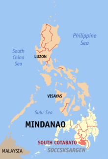
Cotabato Selatan (Filipino:Timog Cotabato) merupakan sebuah provinsi di Filipina dengan ibu kotanya berada di Kota Koronadal. Provinsi ini terletak di region/daerah Soccsksargen, dan memiliki luas wilayah 3.936 km² dengan jumlah penduduk 767.255 jiwa (2007). Provinsi ini memiliki angka kepadatan penduduk 195 jiwa/km².
Pembagian wilayah
Secara administratif provinsi Cotabato Selatan terbagi menjadi 10 munisipalitas, 1 kota komponen dan 1 kota independen, yaitu:
| City/Municipality | No. of Barangays |
Area (km²) |
Population (2010) |
Pop. density (per km²) |
District | Class Income | Classification | |
|---|---|---|---|---|---|---|---|---|
| Berkas:Ph Polomolok Seal.png | Polomolok | |||||||
| Tupi | ||||||||
| Berkas:Koronadal logo.jpg | Koronadal | |||||||
| Berkas:Ph seal gensan.png | General Santos | |||||||
| Banga | ||||||||
| Lake Sebu | ||||||||
| Norala | ||||||||
| Santo Niño | ||||||||
| Surallah | ||||||||
| T'Boli | ||||||||
| Tampakan | ||||||||
| Tantangan | ||||||||

