
Berkas:Vinson-Map.jpg

Ukuran pratayang ini: 626 × 599 piksel. Resolusi lainnya: 251 × 240 piksel | 501 × 480 piksel | 802 × 768 piksel | 1.070 × 1.024 piksel | 2.139 × 2.048 piksel | 3.207 × 3.070 piksel.
Ukuran asli (3.207 × 3.070 piksel, ukuran berkas: 5,48 MB, tipe MIME: image/jpeg)
| Deskripsi |
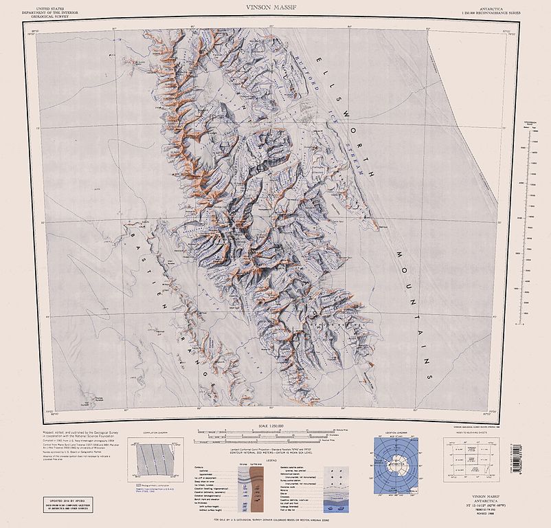
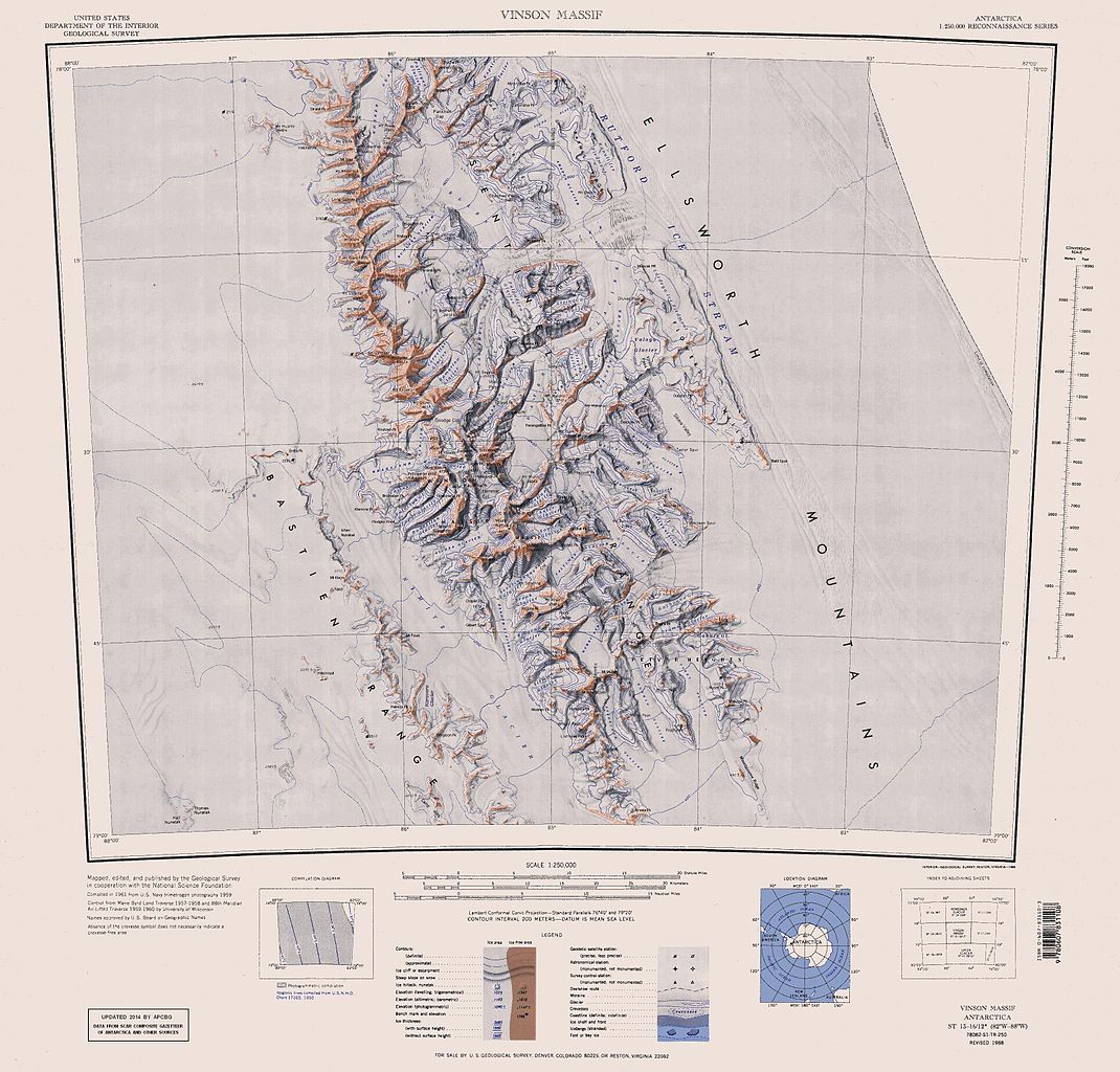
English: Map of Antarctica by the United States Antarctic Resource Center of the US Geological Survey (USGS). |
| Tanggal | |
| Sumber | https://usarc.usgs.gov/drgs/dir1/c78082s1.jpg |
| Pembuat | United States Department of the Interior: Geological Survey |
| Versi lainnya |
Trimmed and updated version of Wikimedia Commons Image:C78082s1_Ant.Map_Vinson_Massif.jpg. |
Gambar ini berada di domain umum di Amerika Serikat karena gamabar ini hanya mengandung bahan yang asli berasal dari Survei Geologi Amerika Serikat, sebuah badan Departemen Dalam Negeri Amerika Serikat. Untuk informasi lebih lanjut, lihat kebijakan hak cipta Survei Geologi Amerika Serikat resmi.
|
Riwayat berkas
Klik pada tanggal/waktu untuk melihat berkas ini pada saat tersebut.
| Tanggal/Waktu | Miniatur | Dimensi | Pengguna | Komentar | |
|---|---|---|---|---|---|
| terkini | 22 Januari 2014 16.25 | | 3.207 × 3.070 (5,48 MB) | Apcbg | Updated with data from SCAR Composite Gazetteer of Antarctica and other sources. |
| 27 Agustus 2013 07.11 |  | 3.207 × 3.070 (5,47 MB) | Apcbg | Updated with data from SCAR Composite Gazetteer of Antarctica and other sources. | |
| 9 Juli 2011 16.34 |  | 3.207 × 3.070 (5,46 MB) | Apcbg | Updated with data from SCAR Composite Gazetteer of Antarctica and other sources. | |
| 8 Maret 2011 17.34 |  | 3.207 × 3.070 (5,47 MB) | Apcbg | Updated with data from SCAR Composite Gazetteer of Antarctica and other sources. | |
| 13 Oktober 2010 16.52 |  | 3.207 × 3.070 (5,45 MB) | Apcbg | Updated with data from SCAR Composite Gazetteer of Antarctica and other sources. | |
| 30 Januari 2007 10.27 |  | 3.207 × 3.070 (5,4 MB) | Apcbg | Map of Antarctica by the United States Antarctic Ressource Center of the US Geological Society. Trimmed version of Wikimedia image C78082s1_Ant.Map_Vinson_Massif.jpg {{PD-US}} Copyrights and Trademarks USGS-authored or produced data and information are |
Penggunaan berkas
Halaman berikut menggunakan berkas ini:
Penggunaan berkas global
Wiki lain berikut menggunakan berkas ini:
- Penggunaan pada ar.wikipedia.org
- Penggunaan pada ast.wikipedia.org
- Penggunaan pada az.wikipedia.org
- Mirovyane zirvəsi
- Zimornitsa zirvəsi
- Fuça zirvəsi
- Bezden zirvəsi
- Oreşak zirvəsi
- Qolemani zirvəsi
- Marsa buzlağı
- Patleyna buzlağı
- Embree buzlağı
- Kopsis buzlağı
- Padala buzlağı
- Ellen buzlağı
- Fonfon buzlağı
- Gerila buzlağı
- Rumyana buzlağı
- Delyo buzlağı
- Burdenis buzlağı
- Arapya buzlağı
- Pulpudeva buzlağı
- Mamarçev zirvəsi
- Rutford
- Penggunaan pada bg.wikipedia.org
- Penggunaan pada ca.wikipedia.org
- Penggunaan pada ceb.wikipedia.org
Lihat lebih banyak penggunaan global dari berkas ini.