
Berkas:Un-angola.png

Ukuran asli (2.349 × 2.947 piksel, ukuran berkas: 1,69 MB, tipe MIME: image/png)
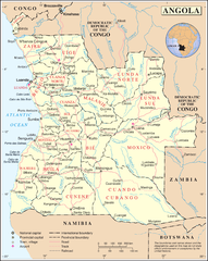
| This image is a map derived from a United Nations map.
Unless stated otherwise, UN maps are to be considered in the public domain. This applies worldwide. UN maps are, in principle, open source material and you can use them in your work or for making your own map. UN requests however that you delete the UN name, logo and reference number upon any modification to the map. Content of your map will be your responsibility. You can state in your publication, if you wish, something like: based on UN map … (map name, map number, revision number and date). See: Geospatial Information Section. And: Geospatial, location data for a better world. |
 |
Riwayat berkas
Klik pada tanggal/waktu untuk melihat berkas ini pada saat tersebut.
| Tanggal/Waktu | Miniatur | Dimensi | Pengguna | Komentar | |
|---|---|---|---|---|---|
| terkini | 23 Oktober 2007 02.50 | | 2.349 × 2.947 (1,69 MB) | Jeroen | {{UN map}} Category:Maps of Angola |
Penggunaan berkas
6 halaman berikut menggunakan berkas ini:
- Resolusi 1173 Dewan Keamanan Perserikatan Bangsa-Bangsa
- Resolusi 1195 Dewan Keamanan Perserikatan Bangsa-Bangsa
- Resolusi 1412 Dewan Keamanan Perserikatan Bangsa-Bangsa
- Resolusi 747 Dewan Keamanan Perserikatan Bangsa-Bangsa
- Resolusi 785 Dewan Keamanan Perserikatan Bangsa-Bangsa
- Resolusi 945 Dewan Keamanan Perserikatan Bangsa-Bangsa
Penggunaan berkas global
Wiki lain berikut menggunakan berkas ini:
- Penggunaan pada ca.wikipedia.org
- Penggunaan pada ckb.wikipedia.org
- Penggunaan pada el.wikipedia.org
- Penggunaan pada en.wikipedia.org
- United Nations Security Council Resolution 1173
- List of rivers of Angola
- United Nations Security Council Resolution 747
- United Nations Security Council Resolution 785
- United Nations Security Council Resolution 945
- United Nations Security Council Resolution 1195
- United Nations Security Council Resolution 1412
- Penggunaan pada fa.wikipedia.org
- Penggunaan pada it.wikipedia.org
- Penggunaan pada mdf.wikipedia.org
- Penggunaan pada mzn.wikipedia.org
- Penggunaan pada nl.wikipedia.org
- Angola
- Resolutie 747 Veiligheidsraad Verenigde Naties
- Resolutie 945 Veiligheidsraad Verenigde Naties
- Resolutie 1173 Veiligheidsraad Verenigde Naties
- Resolutie 1195 Veiligheidsraad Verenigde Naties
- Resolutie 1219 Veiligheidsraad Verenigde Naties
- Resolutie 1412 Veiligheidsraad Verenigde Naties
- Lijst van rivieren in Angola
- Penggunaan pada pl.wiktionary.org
- Penggunaan pada ru.wikipedia.org
- Penggunaan pada sw.wikipedia.org
- Penggunaan pada tg.wikipedia.org
Lihat lebih banyak penggunaan global dari berkas ini.