
Berkas:South Sudan Unity State - Detailed Transport Map Jan 2013.pdf
Ukuran asli (3.506 × 4.966 piksel, ukuran berkas: 6,82 MB, tipe MIME: application/pdf)
Ringkasan
| Deskripsi |
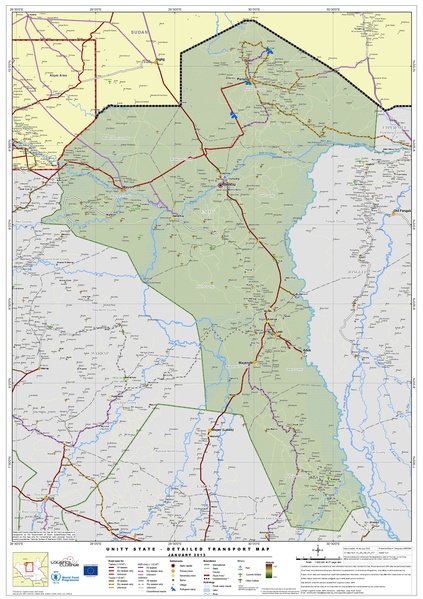
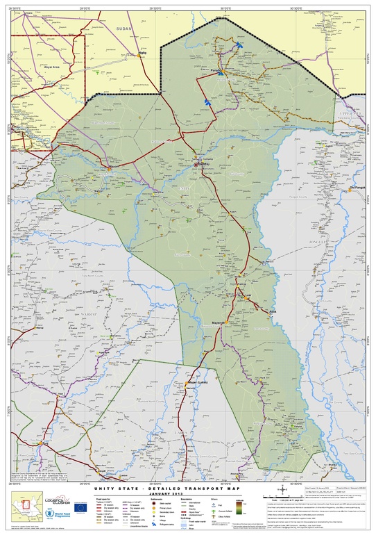
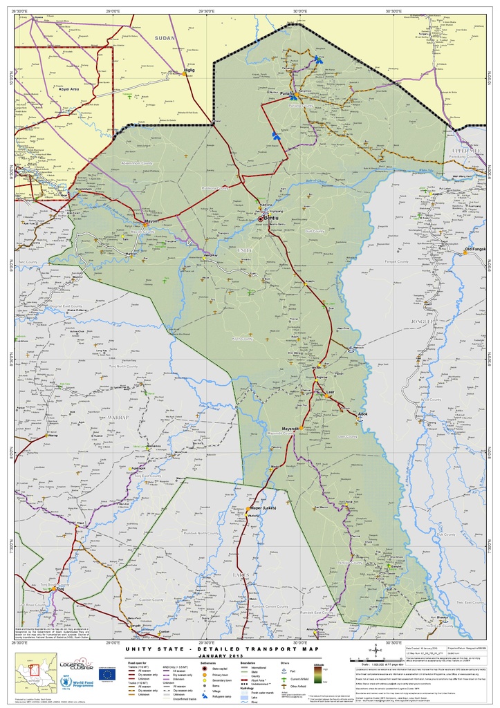
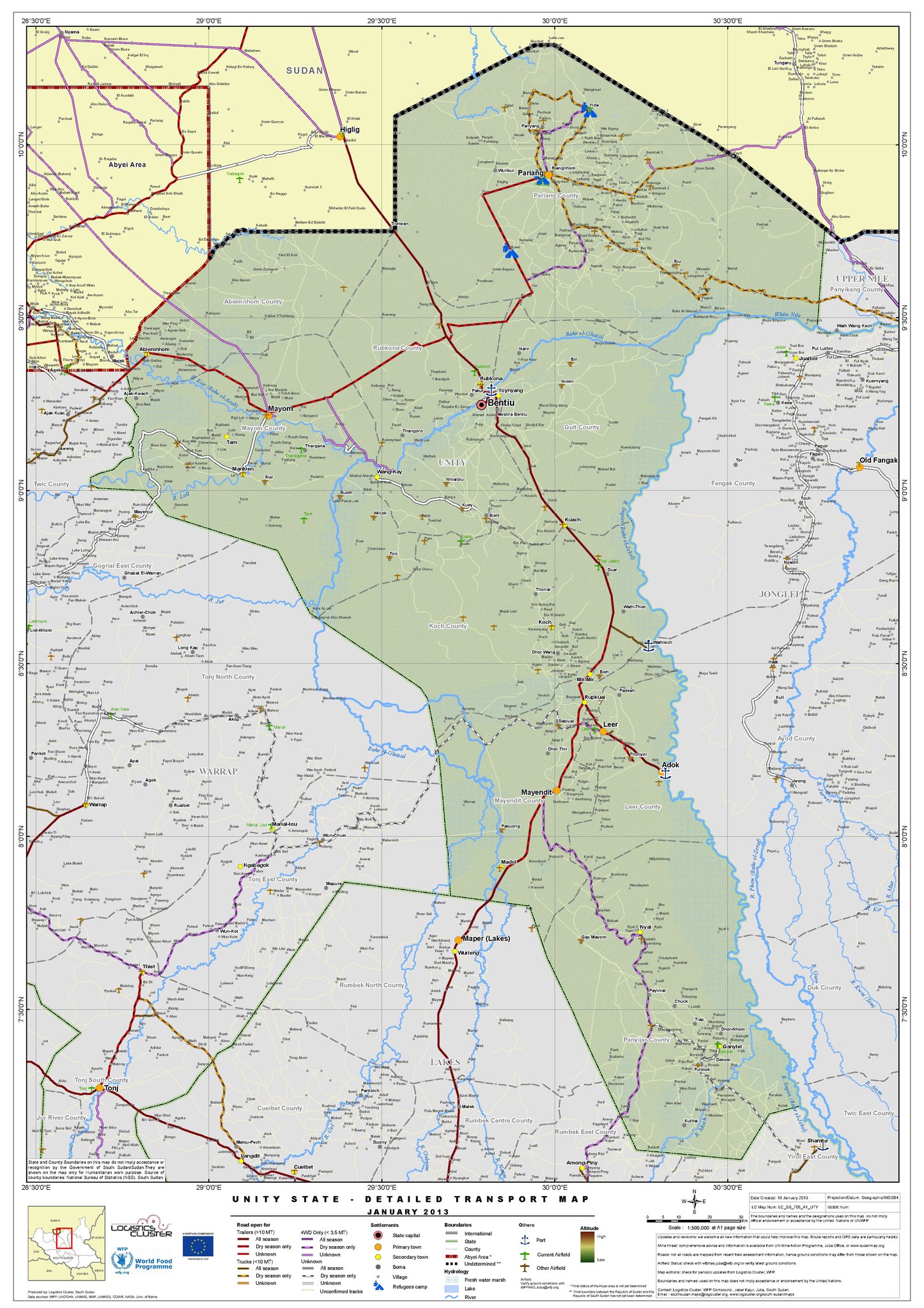
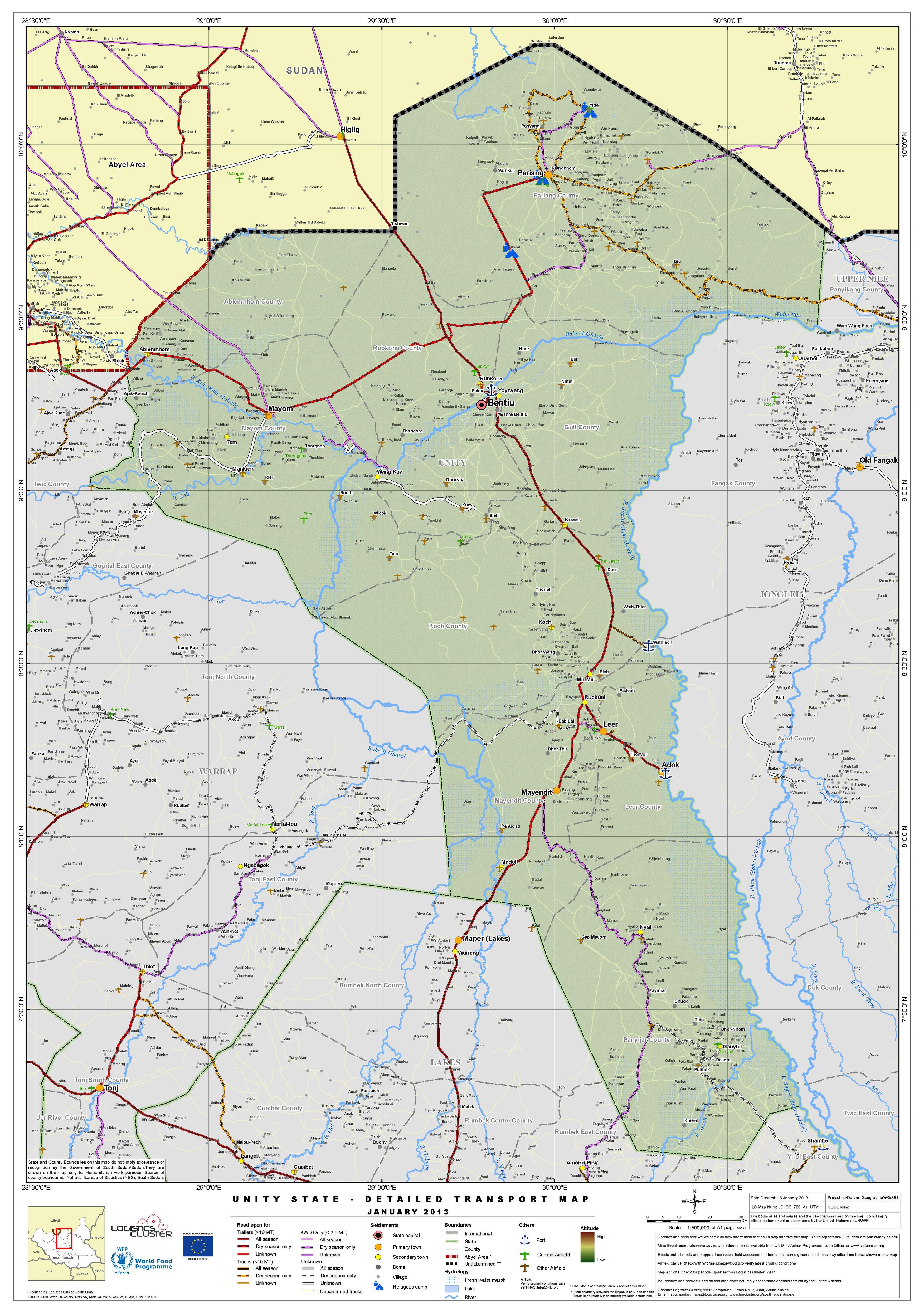
English: Transport map of Unity State (January 2013) |
| Tanggal | |
| Sumber | http://reliefweb.int/sites/reliefweb.int/files/resources/South%20Sudan%20Unity%20State%20-%20Detailed%20Transport%20Map%20%20Jan%202013.pdf |
| Pembuat | United Nations World Food Programme |
Lisensi
| This image is a map derived from a United Nations map.
Unless stated otherwise, UN maps are to be considered in the public domain. This applies worldwide. UN maps are, in principle, open source material and you can use them in your work or for making your own map. UN requests however that you delete the UN name, logo and reference number upon any modification to the map. Content of your map will be your responsibility. You can state in your publication, if you wish, something like: based on UN map … (map name, map number, revision number and date). See: Geospatial Information Section. And: Geospatial, location data for a better world. |
 |
Riwayat berkas
Klik pada tanggal/waktu untuk melihat berkas ini pada saat tersebut.
| Tanggal/Waktu | Miniatur | Dimensi | Pengguna | Komentar | |
|---|---|---|---|---|---|
| terkini | 21 Februari 2017 01.09 |  | 3.506 × 4.966 (6,82 MB) | Wnt | User created page with UploadWizard |
Penggunaan berkas
Halaman berikut menggunakan berkas ini:
Penggunaan berkas global
Wiki lain berikut menggunakan berkas ini:
- Penggunaan pada ar.wikipedia.org
- Penggunaan pada en.wikipedia.org
- Penggunaan pada fr.wikipedia.org