
Berkas:Political map of England 1140.PNG
Ukuran pratayang ini: 736 × 600 piksel. Resolusi lainnya: 295 × 240 piksel | 589 × 480 piksel | 943 × 768 piksel | 1.257 × 1.024 piksel | 1.489 × 1.213 piksel.
Ukuran asli (1.489 × 1.213 piksel, ukuran berkas: 163 KB, tipe MIME: image/png)
Ringkasan
| Deskripsi |
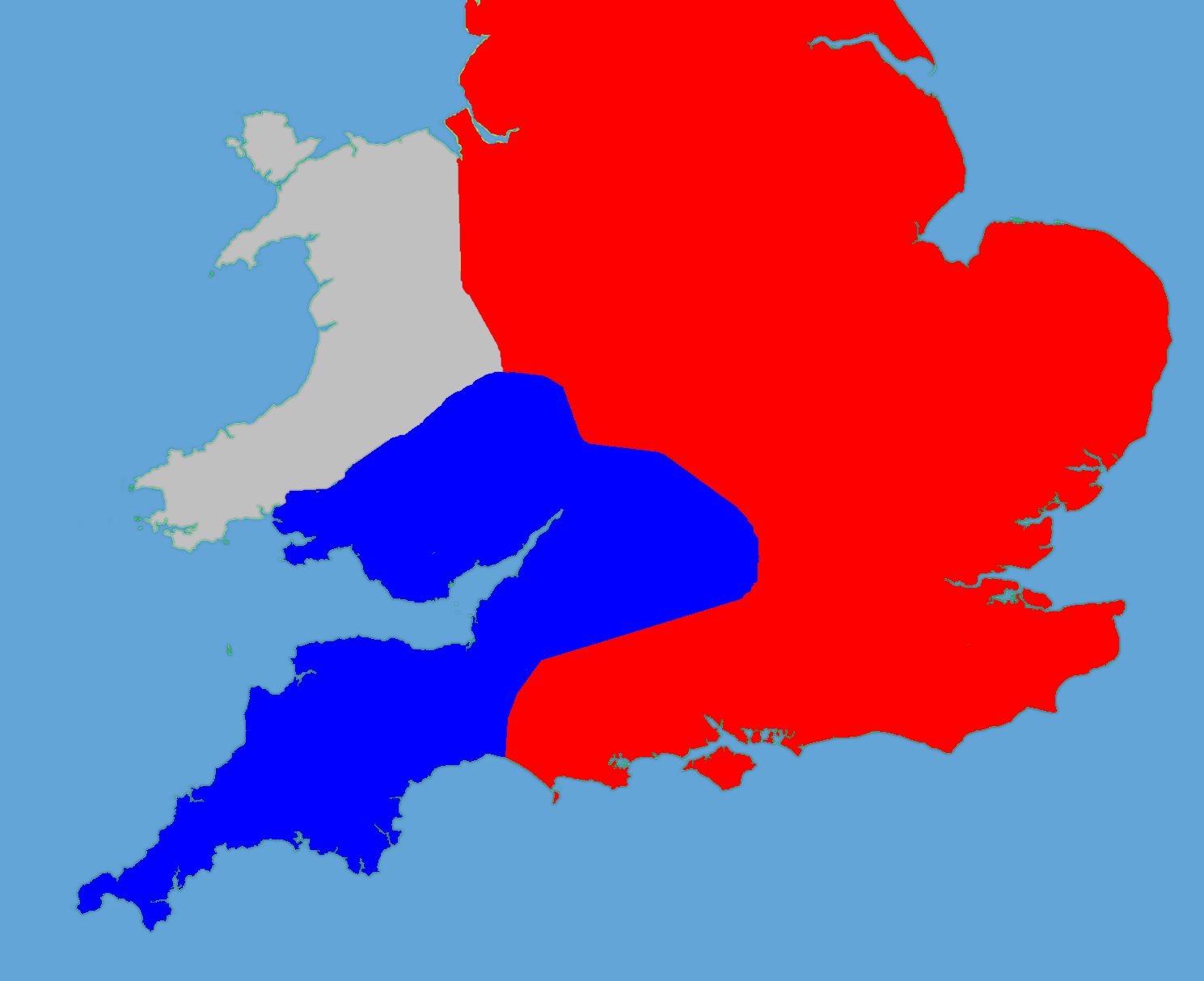
English: A political map of England in 1140 |
| Tanggal | (UTC) |
| Sumber |
Own work using:
|
| Pembuat |
|
| Ini merupakan gambar hasil penyuntingan yang berarti bahwa gambar tersebut telah diubah secara digital dari versi asli. Perubahan: Retouched, historical data added. Versi asli dapat dilihat di sini: Gb4dot.svg:
|
Saya, pemilik hak cipta dari karya ini, dengan ini menerbitkan berkas ini di bawah ketentuan berikut:
| Saya, pemegang hak cipta karya ini, merilis karya ini ke domain umum. Lisensi ini berlaku di seluruh dunia. Di sejumlah negara, tindakan ini tidak memungkinkan secara sah; bila seperti itu: Saya memberikan siapa pun hak untuk menggunakan karya ini untuk tujuan apa pun, tanpa persyaratan apa pun, kecuali yang ditetapkan oleh hukum. |
Log pengunggahan asli
This image is a derivative work of the following images:
- File:Gb4dot.svg licensed with PD-self
Uploaded with derivativeFX
Riwayat berkas
Klik pada tanggal/waktu untuk melihat berkas ini pada saat tersebut.
| Tanggal/Waktu | Miniatur | Dimensi | Pengguna | Komentar | |
|---|---|---|---|---|---|
| terkini | 27 Mei 2011 18.14 | | 1.489 × 1.213 (163 KB) | Hchc2009 | Trimmed to just show the south and Wales |
| 27 Mei 2011 18.11 |  | 1.489 × 1.753 (224 KB) | Hchc2009 | {{Information |Description=A political map of England in 1140, based on data in Jim Bradbury's book "Stephen and Matilda", p.89 and p.180. The original map was a blank locator map for Great Britain. The idea is to superimpose Image:dot4gb.svg at the |
Penggunaan berkas
Halaman berikut menggunakan berkas ini:
Penggunaan berkas global
Wiki lain berikut menggunakan berkas ini:
- Penggunaan pada bg.wikipedia.org
- Penggunaan pada en.wikipedia.org
- Penggunaan pada gl.wikipedia.org
- Penggunaan pada hu.wikipedia.org
- Penggunaan pada it.wikipedia.org
- Penggunaan pada ja.wikipedia.org
- Penggunaan pada no.wikipedia.org
- Penggunaan pada pt.wikipedia.org
- Penggunaan pada ru.wikipedia.org
- Penggunaan pada tr.wikipedia.org