
Berkas:Mid-ocean ridge system.gif

Ukuran pratayang ini: 800 × 487 piksel. Resolusi lainnya: 320 × 195 piksel | 640 × 389 piksel | 1.152 × 701 piksel.
Ukuran asli (1.152 × 701 piksel, ukuran berkas: 500 KB, tipe MIME: image/gif)
Ringkasan
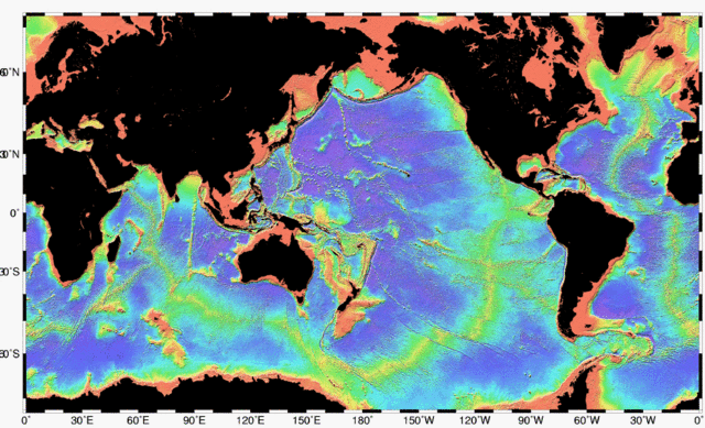
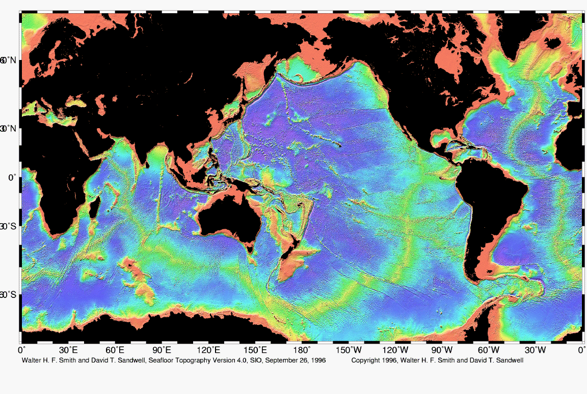
| Deskripsi | Map of the mid-ocean ridge system (yellow-green) in the Earth’s oceans. |
| Tanggal | |
| Sumber | http://www.ngdc.noaa.gov/mgg/image/global_topo_large.gif |
| Pembuat | National Oceanic and Atmospheric Administration |
Lisensi
This image is in the public domain because it contains materials that originally came from the U.S. National Oceanic and Atmospheric Administration, taken or made as part of an employee's official duties.
|
Riwayat berkas
Klik pada tanggal/waktu untuk melihat berkas ini pada saat tersebut.
| Tanggal/Waktu | Miniatur | Dimensi | Pengguna | Komentar | |
|---|---|---|---|---|---|
| terkini | 1 Mei 2010 02.48 | | 1.152 × 701 (500 KB) | Adrignola | {{Information |Description=Map of the mid-ocean ridge system (yellow-green) in the Earth’s oceans. |Source=http://www.ngdc.noaa.gov/mgg/image/global_topo_large.gif |Date=1996-09-26 |Author=w:National Oceanic and Atmospheric Administration |Permissi |
Penggunaan berkas
Halaman berikut menggunakan berkas ini:
Penggunaan berkas global
Wiki lain berikut menggunakan berkas ini:
- Penggunaan pada ban.wikipedia.org
- Penggunaan pada en.wikipedia.org
- Penggunaan pada en.wikibooks.org
- Penggunaan pada en.wiktionary.org
- Penggunaan pada es.wikibooks.org
- Penggunaan pada hy.wikipedia.org
- Penggunaan pada ko.wikipedia.org
- Penggunaan pada ru.wikipedia.org
- Penggunaan pada tw.wikipedia.org