
Berkas:Map for the Silesian and Seven Years Wars.jpg

Ukuran pratayang ini: 800 × 592 piksel. Resolusi lainnya: 320 × 237 piksel | 640 × 474 piksel | 1.024 × 758 piksel | 1.280 × 948 piksel | 1.672 × 1.238 piksel.
Ukuran asli (1.672 × 1.238 piksel, ukuran berkas: 438 KB, tipe MIME: image/jpeg)
Ringkasan
| Deskripsi |
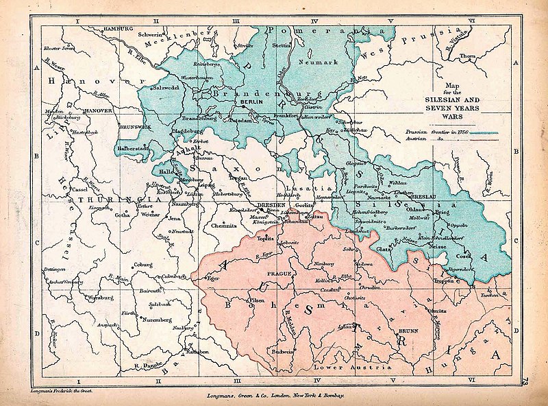
English: A map of Central Europe depicting the principal regions of conflict in the Silesian Wars of the 1740s–60s. The blue and red regions highlight Prussian and Austrian territory (respectively) as of 1756. |
| Tanggal | |
| Sumber | The map is taken from "The Public Schools Historical Atlas" by Charles Colbeck. Longmans, Green, & Co.: New York; London; Bombay. 1905. It was accessed through the University of Texas at Austin's Perry-Castañeda Library Map Collection. The original map comes from "Frederick the Great and the Seven Years' War" by Frederick William Longman (1881). |
| Pembuat |
Frederick William Longman Charles Colbeck (editor) |
Lisensi
|
The author died in 1908, so this work is in the public domain in its country of origin and other countries and areas where the copyright term is the author's life plus 100 years or fewer. Karya ini berada dalam domain publik di Amerika Serikat karena karya ini dipublikasikan (atau didaftarkan di U.S. Copyright Office) sebelum 1 Januari 1929. | |
| Berkas ini telah diidentifikasi bebas dari pembatasan menurut hukum hak cipta termasuk semua hak terkait dan relevan. | |
Riwayat berkas
Klik pada tanggal/waktu untuk melihat berkas ini pada saat tersebut.
| Tanggal/Waktu | Miniatur | Dimensi | Pengguna | Komentar | |
|---|---|---|---|---|---|
| terkini | 7 Oktober 2019 12.25 | | 1.672 × 1.238 (438 KB) | Soerfm | Contrast |
| 7 Januari 2019 17.42 |  | 1.672 × 1.238 (338 KB) | Bryanrutherford0 | User created page with UploadWizard |
Penggunaan berkas
3 halaman berikut menggunakan berkas ini:
Penggunaan berkas global
Wiki lain berikut menggunakan berkas ini:
- Penggunaan pada cs.wikipedia.org
- Penggunaan pada en.wikipedia.org
- Silesian Wars
- Second Silesian War
- Wikipedia:Featured topics
- First Silesian War
- Third Silesian War
- Wikipedia:Featured and good topic candidates/Silesian Wars/archive1
- Wikipedia:Featured and good topic candidates/Featured log/June 2019
- Wikipedia:Featured and good topic candidates/Good log/June 2019
- Wikipedia:Featured topics/Silesian Wars
- Wikipedia:Today's featured article/requests/Silesian Wars
- Penggunaan pada es.wikipedia.org
- Penggunaan pada fr.wikipedia.org
- Penggunaan pada he.wikipedia.org
- Penggunaan pada ja.wikipedia.org
- Penggunaan pada ka.wikipedia.org
- Penggunaan pada pt.wikipedia.org
- Penggunaan pada ru.wikipedia.org
- Penggunaan pada sr.wikipedia.org
- Penggunaan pada vi.wikipedia.org
- Penggunaan pada zh.wikipedia.org