
Berkas:LouisXIV maps1700 Bruxelles.jpg
Ukuran pratayang ini: 750 × 599 piksel. Resolusi lainnya: 301 × 240 piksel | 601 × 480 piksel | 961 × 768 piksel | 1.280 × 1.023 piksel | 2.560 × 2.045 piksel | 6.447 × 5.151 piksel.
Ukuran asli (6.447 × 5.151 piksel, ukuran berkas: 4,78 MB, tipe MIME: image/jpeg)
Ringkasan
| Deskripsi |
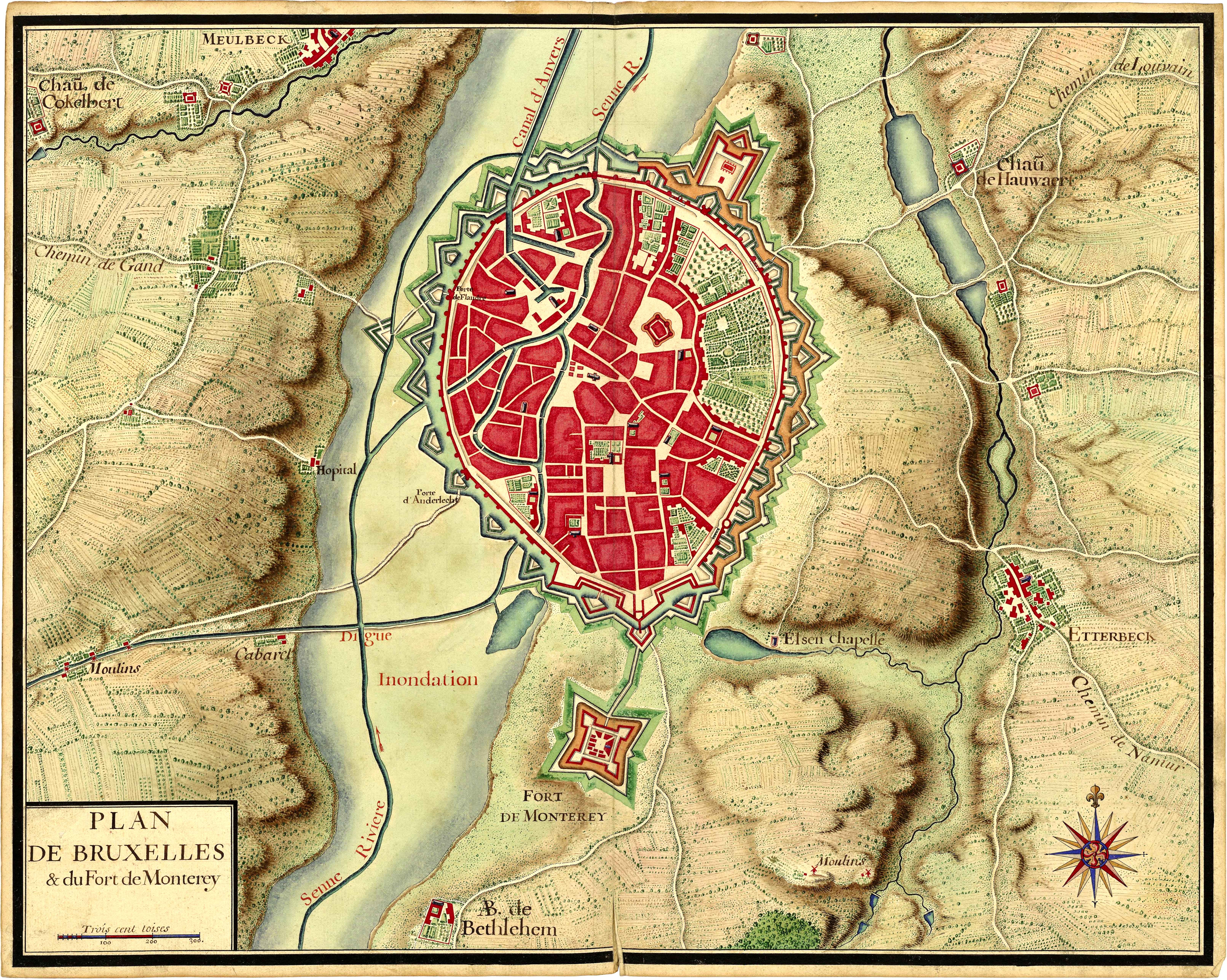
Français : Plan de Bruxelles provenant de la collection de cartes réunies pour Louis XIV lors de la guerre de succession d'Espagne (1701-1714). Extrait du Recueil de cartes des environs de plusieurs places et de parties de France, des Pays-Bas espagnols et hollandois, d'Allemagne, d'Autriche et d'Italie. |
||||
| Tanggal | circa 1700 | ||||
| Sumber |
Bibliothèque nationale de France |
||||
| Pembuat | Tak diketahui | ||||
| Izin (Menggunakan kembali berkas ini) |
|
| Lokasi kamera | | Lihat gambar ini dan gambar di sekitarnya di: OpenStreetMap |
|---|
| Ini merupakan gambar hasil penyuntingan yang berarti bahwa gambar tersebut telah diubah secara digital dari versi asli. Perubahan: Luminosity and constrast enhancement, stains and scratches on borders removed, slight global rotation.
|
Lisensi
|
This work is in the public domain in its country of origin and other countries and areas where the copyright term is the author's life plus 100 years or fewer. | |
| Berkas ini telah diidentifikasi bebas dari pembatasan menurut hukum hak cipta termasuk semua hak terkait dan relevan. | |
Riwayat berkas
Klik pada tanggal/waktu untuk melihat berkas ini pada saat tersebut.
| Tanggal/Waktu | Miniatur | Dimensi | Pengguna | Komentar | |
|---|---|---|---|---|---|
| terkini | 7 Oktober 2011 06.20 | | 6.447 × 5.151 (4,78 MB) | Benwik | {{Information |Description ={{fr|1=Plan de Bruxelles provenant de la collection de cartes réunies pour Louis XIV lors de la guerre de succession d'Espagne (1701-1714). Extrait du Recueil de cartes des environs de plusieurs places et de parties de Fran |
Penggunaan berkas
2 halaman berikut menggunakan berkas ini:
Penggunaan berkas global
Wiki lain berikut menggunakan berkas ini:
- Penggunaan pada en.wikipedia.org
- Penggunaan pada fr.wikipedia.org
- Penggunaan pada it.wikipedia.org
- Penggunaan pada nl.wikipedia.org
- Penggunaan pada sl.wikipedia.org