
Berkas:ISS-30 Lake Fitri, Chad.jpg
Ukuran pratayang ini: 800 × 531 piksel. Resolusi lainnya: 320 × 213 piksel | 640 × 425 piksel | 1.024 × 680 piksel | 1.280 × 850 piksel | 2.560 × 1.700 piksel | 4.288 × 2.848 piksel.
Ukuran asli (4.288 × 2.848 piksel, ukuran berkas: 6,37 MB, tipe MIME: image/jpeg)
Ringkasan
| Deskripsi |
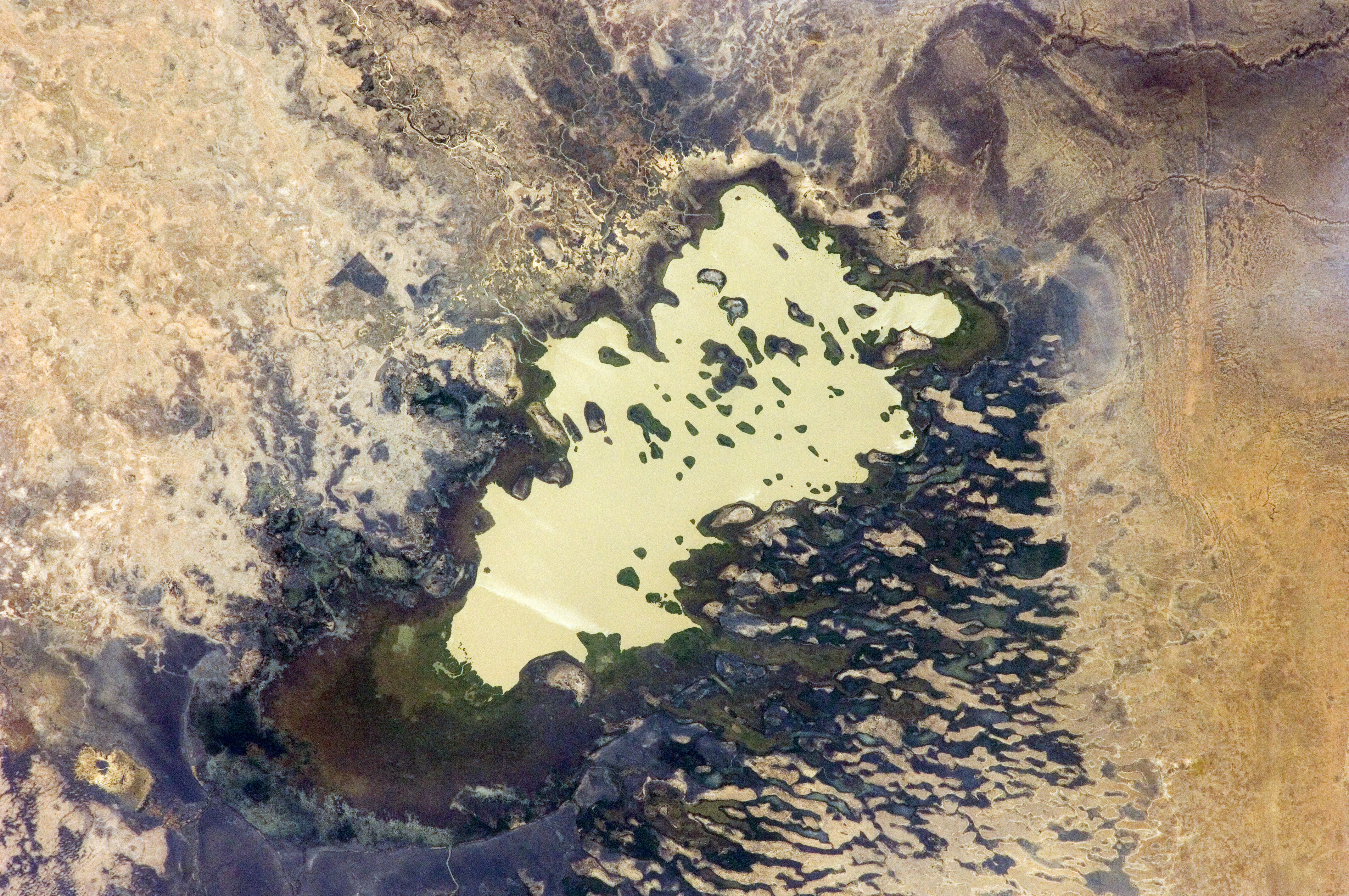
English: Lake Fitri, Chad is featured in this image photographed by an Expedition 30 crew member on the International Space Station.
|
| Tanggal | |
| Sumber | http://spaceflight.nasa.gov/gallery/images/station/crew-30/html/iss030e059398.html |
| Pembuat | NASA |
Gambar atau video ini telah dikatalogkan oleh Pusat Antariksa Johnson milik National Aeronautics and Space Administration (NASA)dibawah ID Foto: ISS030-E-059398. Label ini tidak menunjukkan status hak cipta dari berkas. Label hak cipta yang biasa tetap dibutuhkan. Lihat Commons:Lisensi. Bahasa lain:
|
Lisensi
This file is in the public domain in the United States because it was created by the Image Science & Analysis Laboratory, of the NASA Johnson Space Center. NASA copyright policy states that "NASA material is not protected by copyright unless noted". (NASA media use guidelines or Conditions of Use of Astronaut Photographs).
Photo source: ISS030-E-59398.
|
Riwayat berkas
Klik pada tanggal/waktu untuk melihat berkas ini pada saat tersebut.
| Tanggal/Waktu | Miniatur | Dimensi | Pengguna | Komentar | |
|---|---|---|---|---|---|
| terkini | 20 April 2016 20.00 | | 4.288 × 2.848 (6,37 MB) | Ras67 | new rendered in high quality from NASA's raw image data |
| 4 Juni 2012 12.46 |  | 4.288 × 2.848 (2,03 MB) | Ras67 | levels | |
| 21 Februari 2012 17.59 |  | 4.288 × 2.848 (1,76 MB) | Ras67 | {{Information |Description ={{en|1=Lake Fitri, Chad is featured in this image photographed by an Expedition 30 crew member on the International Space Station. Lake Fitri is an endorheic, or terminal lake in a desert basin in the southern Sahara Desert. |
Penggunaan berkas
Halaman berikut menggunakan berkas ini:
Penggunaan berkas global
Wiki lain berikut menggunakan berkas ini:
- Penggunaan pada ar.wikipedia.org
- Penggunaan pada arz.wikipedia.org
- Penggunaan pada be.wikipedia.org
- Penggunaan pada cv.wikipedia.org
- Penggunaan pada de.wikipedia.org
- Penggunaan pada el.wikipedia.org
- Penggunaan pada en.wikipedia.org
- Penggunaan pada es.wikipedia.org
- Penggunaan pada fr.wikipedia.org
- Penggunaan pada it.wikipedia.org
- Penggunaan pada ka.wikipedia.org
- Penggunaan pada lt.wikipedia.org
- Penggunaan pada my.wikipedia.org
- Penggunaan pada nl.wikipedia.org
- Penggunaan pada pl.wikipedia.org
- Penggunaan pada ru.wikipedia.org
- Penggunaan pada vi.wikipedia.org
- Penggunaan pada www.wikidata.org