
Berkas:Cenepa river basin.jpg
Ukuran pratayang ini: 476 × 600 piksel. Resolusi lainnya: 190 × 240 piksel | 381 × 480 piksel | 965 × 1.216 piksel.
Ukuran asli (965 × 1.216 piksel, ukuran berkas: 900 KB, tipe MIME: image/jpeg)
Ringkasan
| Deskripsi |
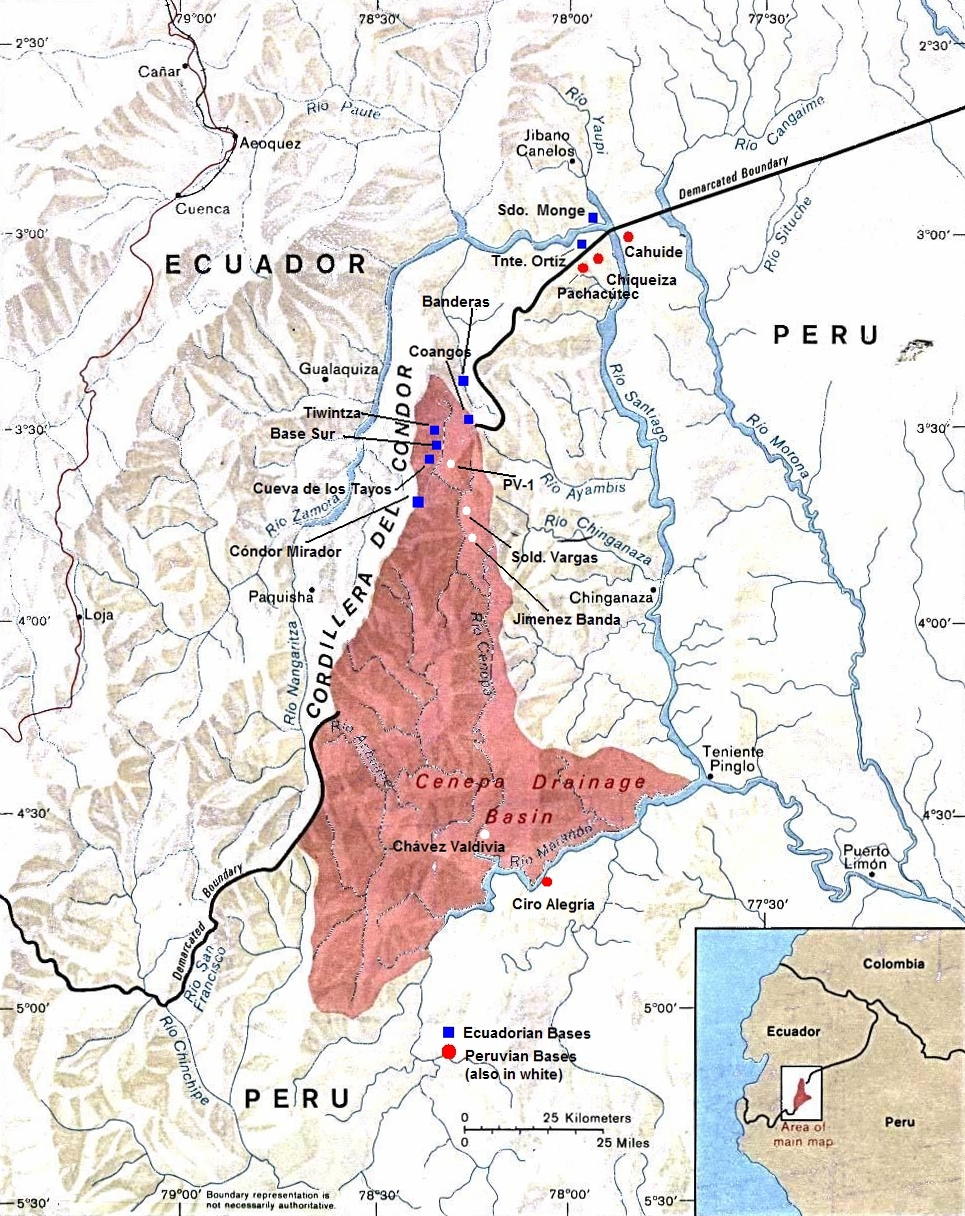
English: Peru-Ecuador (Area of Boundary Dispute). |
| Tanggal | Tanggal tak diketahui |
| Sumber | |
| Pembuat | The University of Texas at Austin |
| Izin (Menggunakan kembali berkas ini) |
Stated as public domain. |
Lisensi
This work is based on a work in the public domain. It has been digitally enhanced and/or modified. This derivative work has been (or is hereby) released into the public domain by its author, Andres C.. This applies worldwide.
In some countries this may not be legally possible; if so: |
Log pengunggahan asli
Halaman deskripsi aslinya ada di sini. Semua nama pengguna berikut merujuk pada en.wikipedia.
- 2010-10-30 14:30 Beao 965×1216× (921862 bytes)
- 2009-10-01 21:16 Andres C. 1000×1292× (876675 bytes) A retouched image of a map located online at the University of Texas Library - PCL Map Collection website. Stated as public domain: http://www.lib.utexas.edu/maps/americas/peru_ecuador_81.jpg "Courtesy of the University of Texas Libraries, The Universit
Riwayat berkas
Klik pada tanggal/waktu untuk melihat berkas ini pada saat tersebut.
| Tanggal/Waktu | Miniatur | Dimensi | Pengguna | Komentar | |
|---|---|---|---|---|---|
| terkini | 15 September 2012 05.31 | | 965 × 1.216 (900 KB) | OgreBot | (BOT): Uploading old version of file from en.wikipedia; originally uploaded on 2010-10-30 14:30:35 by Beao |
| 10 Agustus 2010 14.47 |  | 1.000 × 1.292 (856 KB) | File Upload Bot (Magnus Manske) | {{BotMoveToCommons|en.wikipedia|year={{subst:CURRENTYEAR}}|month={{subst:CURRENTMONTHNAME}}|day={{subst:CURRENTDAY}}}} {{Information |Description={{en|A retouched image of a map located online at the University of Texas Library - PCL Map Collection websi |
Penggunaan berkas
Halaman berikut menggunakan berkas ini:
Penggunaan berkas global
Wiki lain berikut menggunakan berkas ini:
- Penggunaan pada az.wikipedia.org
- Penggunaan pada ca.wikipedia.org
- Penggunaan pada de.wikipedia.org
- Penggunaan pada en.wikipedia.org
- Penggunaan pada es.wikipedia.org
- Penggunaan pada et.wikipedia.org
- Penggunaan pada fi.wikipedia.org
- Penggunaan pada he.wikipedia.org
- Penggunaan pada it.wikipedia.org
- Penggunaan pada ka.wikipedia.org
- Penggunaan pada pt.wikipedia.org
- Penggunaan pada qu.wikipedia.org
- Penggunaan pada ru.wikipedia.org
- Penggunaan pada sv.wikipedia.org
- Penggunaan pada uk.wikipedia.org
- Penggunaan pada www.wikidata.org
- Penggunaan pada zh.wikipedia.org